Area Overview for NN18 0SG
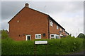
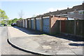
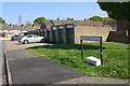
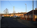
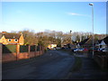
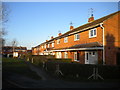
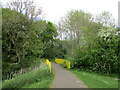
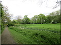
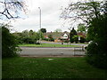
Photos of NN18 0SG


Area Information
NN18 0SG is a small, densely populated residential cluster in Northamptonshire, England, with a population of 1,589 spread across 7,296 square metres. This makes it one of the most densely populated areas in the country, with 217,786 people per square kilometre. The postcode falls within Corby, a town designated a new town in 1950, known for its industrial heritage and historical roots. Originally named “Kori’s by” in the 8th century, Corby’s economy was built on iron and steel production, a legacy still visible in its infrastructure. Today, the area is a compact residential hub, with a focus on houses rather than flats. Living here means proximity to a mix of retail, transport, and community facilities, though the small size of the postcode means amenities are tightly concentrated. The area’s history as a former industrial town contrasts with its current character as a mature, low-density residential zone with a population skewed towards adults aged 30–64.
- Area Type
- Postcode
- Area Size
- 7296 m²
- Population
- 1589
- Population Density
- 6261 people/km²
The property market in NN18 0SG is characterised by a low home ownership rate of 36%, suggesting that the area is primarily a rental market rather than an owner-occupied one. The accommodation type is predominantly houses, which is notable given the high population density. This combination implies a limited supply of residential properties, with houses likely being the main option for buyers. The small size of the postcode (7,296 m²) means that the housing stock is tightly concentrated, potentially limiting availability for those seeking to purchase. For buyers, this could mean competition for a small number of properties, particularly as the area’s industrial heritage may not align with modern preferences for newer developments. The high density also means that proximity to amenities is a key selling point, though the small size of the area may restrict expansion or new housing projects.
House Prices in NN18 0SG
Showing 20 properties
| Address | Type | Beds | Baths | Last Sale Price | Last Sale Date | |
|---|---|---|---|---|---|---|
| 11 Dobson Walk, Corby, NN18 0SG | Terraced | 3 | 1 | £180,000 | Jun 2025 | |
| 19 Dobson Walk, Corby, NN18 0SG | house | - | - | £175,000 | Jul 2024 | |
| 8 Dobson Walk, Corby, NN18 0SG | house | - | - | £185,000 | Oct 2021 | |
| 14 Dobson Walk, Corby, NN18 0SG | house | - | - | £426,667 | Nov 2020 | |
| 17 Dobson Walk, Corby, NN18 0SG | house | - | - | £138,000 | Sep 2019 | |
| 12 Dobson Walk, Corby, NN18 0SG | Semi-detached | 4 | 1 | £122,500 | Mar 2016 | |
| 21 Dobson Walk, Corby, NN18 0SG | Terraced | 3 | - | £100,000 | Mar 2015 | |
| 3 Dobson Walk, Corby, NN18 0SG | house | 3 | - | £85,000 | Sep 2006 | |
| 15 Dobson Walk, Corby, NN18 0SG | Terraced | 3 | 1 | £67,995 | Sep 2004 | |
| 13 Dobson Walk, Corby, NN18 0SG | house | - | - | £36,000 | May 2002 |
Energy Efficiency in NN18 0SG
The lifestyle in NN18 0SG is shaped by its compact size and proximity to essential amenities. Within practical reach are five retail outlets, including Iceland Corby, Lidl Central, and Spar, catering to daily shopping needs. The area is served by Corby Railway Station and a bus interchange, facilitating travel to nearby towns and cities. While the range of amenities is limited, their concentration makes them easily accessible. The presence of schools, retail, and transport links suggests a functional, community-focused environment. However, the lack of larger leisure or recreational facilities may require residents to travel further for activities beyond basic needs. The area’s character is defined by its practicality, with amenities prioritising convenience over variety.
Amenities
Schools
The schools nearest to NN18 0SG include Hazel Leys Infant School, a primary school, and Maplefields School, a special school. These institutions cater to a range of educational needs, from early years to specialist provisions. The presence of a primary school ensures that young families have access to local education, while the special school provides tailored support for students with specific requirements. However, the absence of secondary schools in the immediate vicinity may require families to seek options further afield. The mix of school types reflects the area’s focus on inclusive education, though the lack of comprehensive schooling within the postcode could be a consideration for parents planning long-term.
| Rank | School | Type | Entry gender | Ages |
|---|
Explore more schools in this area
Go to Schools tabDemographics
The community in NN18 0SG is predominantly composed of adults aged 30–64, with a median age of 47. This suggests a mature population, likely with established careers and families. Home ownership is low at 36%, indicating that most residents are renters, which may reflect the area’s history as a planned industrial town with housing stock developed for workers. The primary accommodation type is houses, rather than flats, which is unusual for a high-density area. The predominant ethnic group is White, though specific data on diversity is not provided. The low home ownership rate and older demographic profile may influence the social fabric, with a focus on long-term residents and limited turnover. The absence of detailed deprivation data means it is unclear how economic challenges might affect quality of life, though the high population density could strain local services.
Household Size
Accommodation Type
Tenure
Ethnic Group
Religion
Household Composition
Age
Household Deprivation
NS-SEC
Explore more demographic insights in this area
Go to Demographics tabPlanning
Planning Constraints
- Flood RiskPremium
- Ramsar Wetland SitesPremium
- Area of Outstanding Natural BeautyPremium
- Protected Nature ReservePremium
- Protected WoodlandPremium