Area Overview for NN18 0RZ
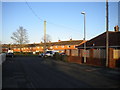
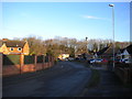
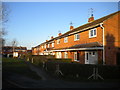
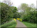
Photos of NN18 0RZ

Area Information
NN18 0RZ is a small residential postcode in Corby, Northamptonshire, part of a town designated as a new settlement in 1950. Covering 3,238 square metres, it is densely populated, with 1,589 residents living at a density of 490,676 people per square kilometre. Corby’s history is rooted in industrial growth, particularly its steelworks, which transformed it from a village into a major settlement. Today, the area reflects a mix of historical and modern influences, with the raven as its symbolic emblem. The community here is older, with a median age of 47, and predominantly composed of adults aged 30–64. Daily life is shaped by proximity to essential services, though the area’s compact size means amenities are closely clustered. Living here offers a tight-knit environment, but the high population density and industrial heritage may influence the character of the neighbourhood. For buyers, the area’s limited size and specific postcode boundaries mean properties are few, requiring careful consideration of location within the broader Corby context.
- Area Type
- Postcode
- Area Size
- 3238 m²
- Population
- 1589
- Population Density
- 6261 people/km²
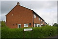
NN18 0RZ is characterised by a housing stock dominated by houses, with 36% of properties owned by residents. Given the area’s small size and high population density, the property market is likely limited to a small number of homes. The low home ownership rate suggests a higher reliance on rental properties, possibly due to the area’s compact nature and limited expansion potential. For buyers, this means competition for available properties, particularly within the immediate postcode boundaries. The predominance of houses may appeal to families seeking more space, but the area’s size restricts the availability of larger or newer developments. Proximity to Corby’s infrastructure, including transport links and retail, could enhance the area’s appeal, though buyers should consider the challenges of a saturated local market and the need for strategic location within the postcode.
House Prices in NN18 0RZ
Showing 10 properties
| Address | Type | Beds | Baths | Last Sale Price | Last Sale Date | |
|---|---|---|---|---|---|---|
| 2 Leonardo Court, Corby, NN18 0RZ | house | - | - | £163,000 | Aug 2019 | |
| 4 Leonardo Court, Corby, NN18 0RZ | house | 1 | 1 | £90,000 | Jun 2010 | |
| 9 Leonardo Court, Corby, NN18 0RZ | house | - | - | £43,000 | Jun 2004 | |
| 3 Leonardo Court, Corby, NN18 0RZ | house | 1 | 1 | £27,625 | May 2004 | |
| 7 Leonardo Court, Corby, NN18 0RZ | house | - | - | - | - | |
| 5 Leonardo Court, Corby, NN18 0RZ | Terraced | - | - | - | - | |
| 1 Leonardo Court, Corby, NN18 0RZ | Terraced | - | - | - | - | |
| 10 Leonardo Court, Corby, NN18 0RZ | Semi-detached | - | - | - | - | |
| 6 Leonardo Court, Corby, NN18 0RZ | Terraced | - | - | - | - | |
| 8 Leonardo Court, Corby, NN18 0RZ | Semi-detached | - | - | - | - |
Energy Efficiency in NN18 0RZ
The lifestyle in NN18 0RZ is shaped by its proximity to essential amenities, including retail outlets such as Iceland Corby, Lidl Central, and Farmfoods Corby. These stores provide convenient access to groceries and daily necessities, supporting a practical, community-focused lifestyle. The area’s transport links, including the railway station and bus interchange, further enhance accessibility to nearby towns and services. While the postcode’s compact size limits the range of leisure options, the presence of retail and transport hubs ensures residents can meet most needs locally. The mix of retail and transport infrastructure suggests a functional, efficient environment, though the lack of detailed information on parks or leisure facilities means the full extent of recreational opportunities remains unclear.
Amenities
Schools
The nearest schools to NN18 0RZ include Hazel Leys Infant School, a primary school serving younger children, and Maplefields School, a special school catering to students with specific educational needs. These institutions reflect a mix of general and specialist education options, offering families a range of choices. The presence of a special school indicates a focus on inclusive education, which may be particularly relevant for households with children requiring tailored support. However, the absence of secondary schools in the immediate area means families may need to consider commuting to nearby towns for higher education. The combination of primary and special schools suggests the area is well-suited for families with younger children, though the lack of comprehensive school options could be a limitation for those requiring full educational continuity.
| Rank | School | Type | Entry gender | Ages |
|---|
Explore more schools in this area
Go to Schools tabDemographics
The population of NN18 0RZ is 1,589, with a median age of 47, indicating a mature demographic. The most common age range is 30–64 years, suggesting a community of established professionals and families. Home ownership is relatively low at 36%, implying a higher proportion of rental properties. The area is predominantly composed of houses, reflecting a traditional housing stock. The predominant ethnic group is White, with no specific data on other demographics provided. This age profile and ownership structure suggest a stable, long-term resident base. However, the low home ownership rate may indicate limited opportunities for property investment or equity growth. The area’s older population could influence local services and amenities, with a focus on accessibility and community support. The absence of detailed diversity statistics means the full range of cultural or social dynamics remains unexplored.
Household Size
Accommodation Type
Tenure
Ethnic Group
Religion
Household Composition
Age
Household Deprivation
NS-SEC
Explore more demographic insights in this area
Go to Demographics tabPlanning
Planning Constraints
- Flood RiskPremium
- Ramsar Wetland SitesPremium
- Area of Outstanding Natural BeautyPremium
- Protected Nature ReservePremium
- Protected WoodlandPremium