Area Overview for NN18 0RX
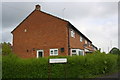
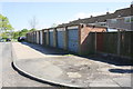
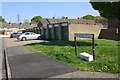
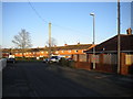
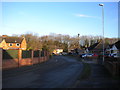
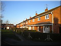
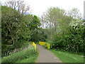
Photos of NN18 0RX

Area Information
Living in NN18 0RX means being part of Corby, a town in Northamptonshire with a distinct industrial heritage and a compact residential character. This postcode area covers just 1.1 hectares, housing 1,589 people in a densely populated cluster. Corby, designated a new town in 1950, has roots stretching back to the 8th century, with its name derived from the Old English “Kori’s by.” The area’s modern identity is shaped by its historical steelworks, which transformed a small village into a bustling hub. Today, NN18 0RX sits within a town that balances its industrial past with contemporary amenities. Residents benefit from proximity to Corby Railway Station and a bus interchange, while nearby schools and retail outlets provide daily convenience. The area’s compact size means it is well-integrated into Corby’s broader infrastructure, though its small footprint means housing options are limited to a handful of properties, predominantly owner-occupied homes.
- Area Type
- Postcode
- Area Size
- 1.1 hectares
- Population
- 1589
- Population Density
- 6261 people/km²
The property market in NN18 0RX is limited by the area’s small size, with housing stock concentrated in a handful of properties. Home ownership stands at 36%, suggesting a mix of owner-occupied and rental properties. The accommodation type is predominantly houses, which may indicate a focus on family homes or single-occupancy residences. Given the area’s compact nature, buyers may need to look beyond NN18 0RX to Corby’s broader residential zones for more options. The low home ownership rate could reflect a reliance on rental markets or shared ownership schemes. For buyers, this small area offers limited scope for property diversity, with potential for investment in existing homes rather than new developments.
House Prices in NN18 0RX
Showing 30 properties
| Address | Type | Beds | Baths | Last Sale Price | Last Sale Date | |
|---|---|---|---|---|---|---|
| 44 Llewellyn Walk, Corby, NN18 0RX | Terraced | 3 | 1 | £165,000 | Aug 2025 | |
| 52 Llewellyn Walk, Corby, NN18 0RX | Terraced | 3 | 1 | £170,000 | Jan 2024 | |
| 60 Llewellyn Walk, Corby, NN18 0RX | Terraced | 3 | 1 | £180,000 | May 2022 | |
| 2 Llewellyn Walk, Corby, NN18 0RX | Terraced | 2 | 1 | £180,000 | Mar 2022 | |
| 30 Llewellyn Walk, Corby, NN18 0RX | Terraced | 3 | 1 | £160,000 | Dec 2021 | |
| 38 Llewellyn Walk, Corby, NN18 0RX | house | - | - | £134,000 | May 2018 | |
| 42 Llewellyn Walk, Corby, NN18 0RX | house | - | - | £135,000 | Dec 2017 | |
| 10 Llewellyn Walk, Corby, NN18 0RX | house | 3 | 1 | £92,000 | Nov 2015 | |
| 18 Llewellyn Walk, Corby, NN18 0RX | house | - | - | £104,950 | Feb 2015 | |
| 26 Llewellyn Walk, Corby, NN18 0RX | Terraced | 3 | 1 | £50,000 | Jun 2011 |
Energy Efficiency in NN18 0RX
The lifestyle in NN18 0RX is shaped by its proximity to essential amenities. Within practical reach are five retail outlets, including Iceland Corby, Farmfoods Corby, and Lidl Central, offering grocery and convenience shopping. The Corby Railway Station and Bus Interchange provide access to public transport, enabling travel to Corby’s town centre or beyond. While the area’s compact size limits larger leisure facilities, its integration with Corby’s infrastructure ensures residents can access parks, dining, and cultural venues in the wider town. The retail options suggest a focus on daily convenience, with a mix of supermarket chains catering to local needs. This blend of practical amenities supports a self-sufficient lifestyle within the area’s small footprint.
Amenities
Schools
Residents of NN18 0RX have access to two schools within practical reach: Hazel Leys Infant School, a primary school, and Maplefields School, a special school. The presence of a primary school caters to younger families, while the special school indicates a focus on supporting students with specific educational needs. This mix suggests the area serves a range of household types, from families with young children to those requiring specialist education. However, the absence of secondary schools nearby means students may need to travel to Corby’s larger schools. The availability of both primary and special schools reflects Corby’s broader commitment to education, though parents should consider travel logistics for older children.
| Rank | School | Type | Entry gender | Ages |
|---|
Explore more schools in this area
Go to Schools tabDemographics
The population of NN18 0RX is 1,589, with a median age of 47 and the majority of residents aged 30–64. This suggests a community skewed towards middle-aged adults, potentially reflecting a mix of long-term residents and professionals working in Corby’s industrial or service sectors. Home ownership in the area is relatively low at 36%, indicating a significant proportion of residents are renters. The accommodation type is predominantly houses, which may appeal to families or individuals seeking more space. The predominant ethnic group is White, though no specific data on diversity or deprivation is provided. The age profile implies a stable, established community, though the lack of younger demographics may affect local amenities tailored to children or students.
Household Size
Accommodation Type
Tenure
Ethnic Group
Religion
Household Composition
Age
Household Deprivation
NS-SEC
Explore more demographic insights in this area
Go to Demographics tabPlanning
Planning Constraints
- Flood RiskPremium
- Ramsar Wetland SitesPremium
- Area of Outstanding Natural BeautyPremium
- Protected Nature ReservePremium
- Protected WoodlandPremium