Area Overview for NN18 0QN
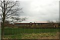
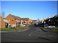
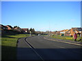
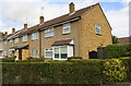
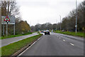
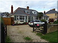
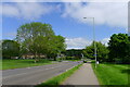
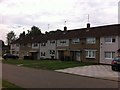
Photos of NN18 0QN


Area Information
NN18 0QN is a compact residential cluster in Corby, Northamptonshire, a town with a distinct industrial heritage. Covering just 1.2 hectares, the area is densely populated, with 1,613 residents living at a density of 133,784 people per square kilometre. This small postcode area reflects Corby’s transformation from a 1950s new town into a modern settlement, shaped by its historical steelworks and ongoing economic evolution. Daily life here is defined by proximity to amenities and a tight-knit community feel. The area’s character is rooted in Corby’s past as a hub of iron and steel production, though today it balances that legacy with contemporary needs. Residents benefit from nearby retail, rail links, and a mix of housing types. While the population is small, the density creates a vibrant, interconnected environment. For homebuyers, NN18 0QN offers a blend of practicality and historical context, with a focus on accessible living in a town that continues to adapt to changing economic landscapes.
- Area Type
- Postcode
- Area Size
- 1.2 hectares
- Population
- 1613
- Population Density
- 7014 people/km²
The property market in NN18 0QN is shaped by its low home ownership rate of 37%, suggesting that a significant portion of the housing stock is rented out. The area is dominated by houses rather than flats, which may appeal to families or those seeking more space. However, the small size of the postcode area—just 1.2 hectares—means the housing stock is limited, potentially making the market competitive for buyers. With a population of 1,613, the demand for housing may outstrip supply, especially given the area’s proximity to amenities and transport links. For buyers, this could mean higher prices or fewer options. The predominance of owner-occupied homes is lower than average, which might indicate a rental-focused market, though the exact balance between rental and purchase opportunities is not specified. Those considering the area should weigh the benefits of proximity to services against the constraints of a small, densely packed housing stock.
House Prices in NN18 0QN
Showing 12 properties
| Address | Type | Beds | Baths | Last Sale Price | Last Sale Date | |
|---|---|---|---|---|---|---|
| 308 Gainsborough Road, Corby, NN18 0QN | house | 2 | 1 | £165,000 | Jun 2025 | |
| 304 Gainsborough Road, Corby, NN18 0QN | Terraced | 2 | 1 | £155,000 | May 2025 | |
| 322 Gainsborough Road, Corby, NN18 0QN | Retail | 2 | 1 | £180,000 | Jul 2022 | |
| 310 Gainsborough Road, Corby, NN18 0QN | house | - | - | £127,500 | Feb 2021 | |
| 300 Gainsborough Road, Corby, NN18 0QN | Terraced | 2 | 1 | £100,000 | Mar 2016 | |
| 316 Gainsborough Road, Corby, NN18 0QN | house | - | - | £87,500 | Nov 2012 | |
| 320 Gainsborough Road, Corby, NN18 0QN | house | - | - | - | - | |
| 318 Gainsborough Road, Corby, NN18 0QN | house | - | - | - | - | |
| 306 Gainsborough Road, Corby, NN18 0QN | Terraced | - | - | - | - | |
| 302 Gainsborough Road, Corby, NN18 0QN | house | - | - | - | - |
Energy Efficiency in NN18 0QN
Living in NN18 0QN offers access to a range of essential amenities within practical reach. The retail sector includes Morrisons Daily Corby, Lidl Central, and Morrisons Daily, providing everyday shopping options for groceries and household items. For transport, Corby Railway Station and Kettering Railway Station are nearby, while a bus interchange adds convenience for public transit users. Although the area is small, these amenities contribute to a functional lifestyle, allowing residents to meet daily needs without long journeys. The presence of multiple retail outlets suggests a focus on practicality, though the absence of detailed information on dining or leisure venues means the area may not cater to more niche interests. Nonetheless, the proximity to rail and bus services, combined with retail options, ensures a convenient and connected lifestyle for residents.
Amenities
Schools
| Rank | School | Type | Entry gender | Ages |
|---|
Explore more schools in this area
Go to Schools tabDemographics
The community in NN18 0QN is predominantly middle-aged, with a median age of 47 and the most common age range being adults aged 30–64. This suggests a stable population with established households. Home ownership is relatively low at 37%, indicating a higher proportion of renters compared to owner-occupiers. The area is characterised by houses as the primary accommodation type, which contrasts with the higher prevalence of flats in some urban areas. The predominant ethnic group is White, reflecting broader demographic trends in Corby. The high population density of 133,784 people per square kilometre means the area is compact and likely to have a strong sense of community, though it may also present challenges in terms of space and infrastructure. For quality of life, this density could mean shorter commutes and easier access to local services, but it may also impact housing availability and affordability.
Household Size
Accommodation Type
Tenure
Ethnic Group
Religion
Household Composition
Age
Household Deprivation
NS-SEC
Explore more demographic insights in this area
Go to Demographics tabPlanning
Planning Constraints
- Flood RiskPremium
- Ramsar Wetland SitesPremium
- Area of Outstanding Natural BeautyPremium
- Protected Nature ReservePremium
- Protected WoodlandPremium