Area Overview for NN18 0PF
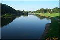
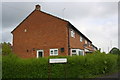
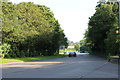
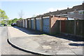
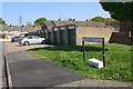
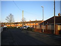
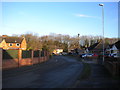
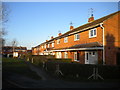
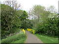
Photos of NN18 0PF
Area Information
Living in NN18 0PF means inhabiting a compact, high-density residential cluster in Corby, Northamptonshire. This area, covering just 3,691 m², is home to 1,318 people, resulting in a population density of over 357,000 people per square kilometre. The town of Corby itself, where this postcode lies, was designated a new town in 1950, transforming from a small village into a hub of industrial activity. Its historical roots stretch back to the 8th century, with a name derived from “Kori’s by,” a settlement of Danish origin. Today, NN18 0PF reflects a mature community, with a median age of 47 and a majority of residents aged 30–64. The area’s character is shaped by its industrial heritage, though modern life here balances practicality with the convenience of nearby amenities. Residents benefit from proximity to retail, transport links, and the town’s historical landmarks, such as the Corby Pole Fair, held every 20 years. Despite its small size, NN18 0PF offers a distinct blend of residential simplicity and regional connectivity.
- Area Type
- Postcode
- Area Size
- 3691 m²
- Population
- 1318
- Population Density
- 3377 people/km²
The property market in NN18 0PF is characterised by a 47% home ownership rate, meaning just under half of residents own their homes. This suggests a rental market that dominates the area, with a focus on long-term lets rather than speculative investment. The accommodation type is primarily houses, which is unusual for a high-density postcode but may reflect the area’s historical development as a residential cluster with standalone properties. Given the small size of NN18 0PF—just 3,691 m²—buyers should expect limited housing stock, with few new developments likely. The compact nature of the area also means that properties are likely to be closely spaced, potentially limiting options for larger families or those seeking more space. For buyers, this small area may offer a niche opportunity, but competition could be fierce due to the limited supply of homes.
House Prices in NN18 0PF
Showing 11 properties
| Address | Type | Beds | Baths | Last Sale Price | Last Sale Date | |
|---|---|---|---|---|---|---|
| 5 Bradford Walk, Corby, NN18 0PF | Semi-detached | 6 | 3 | £257,000 | Sep 2022 | |
| 7 Bradford Walk, Corby, NN18 0PF | house | - | - | £152,000 | Feb 2021 | |
| 3 Bradford Walk, Corby, NN18 0PF | Semi-detached | 4 | - | £118,500 | Nov 2015 | |
| 1 Bradford Walk, Corby, NN18 0PF | Semi-detached | 1 | - | £80,000 | Feb 2011 | |
| 2 Bradford Walk, Corby, NN18 0PF | Semi-detached | 1 | - | £91,000 | May 2006 | |
| 12 Bradford Walk, Corby, NN18 0PF | Terraced | 3 | - | £28,000 | Apr 2001 | |
| 10 Bradford Walk, Corby, NN18 0PF | Semi-detached | 5 | - | - | - | |
| 6 Bradford Walk, Corby, NN18 0PF | Semi-detached | 1 | - | - | - | |
| 8 Bradford Walk, Corby, NN18 0PF | house | - | - | - | - | |
| 4 Bradford Walk, Corby, NN18 0PF | Semi-detached | - | - | - | - |
Energy Efficiency in NN18 0PF
Life in NN18 0PF is shaped by its proximity to essential amenities. Within practical reach are five retail outlets, including Morrisons Daily Corby and Spar, ensuring residents have access to daily necessities. The Corby Railway Station and nearby bus interchange provide straightforward connections to nearby towns and cities, making commuting or weekend trips feasible. While the area is small, the presence of these amenities suggests a practical, no-frills lifestyle focused on convenience. The lack of extensive parks or leisure facilities means residents may need to travel further for recreational activities, but the compact nature of the area reduces commuting times for local errands. The retail options, combined with transport links, support a self-contained lifestyle, though those seeking more extensive leisure options may need to look beyond NN18 0PF.
Amenities
Schools
| Rank | School | Type | Entry gender | Ages |
|---|
Explore more schools in this area
Go to Schools tabDemographics
The community in NN18 0PF is predominantly composed of adults aged 30–64, with a median age of 47. This suggests a mature, stable population, likely with established careers and families. Home ownership rates stand at 47%, indicating that nearly half of residents rent their homes, while the other 53% are likely in rental properties or other tenures. The accommodation type is primarily houses, reflecting a preference for standalone homes over flats or apartments. The predominant ethnic group is White, aligning with broader trends in the region. With a population density of 357,000 people per square kilometre, the area is exceptionally compact, which may influence social dynamics and access to shared spaces. While the data does not specify deprivation levels, the high density and moderate age range suggest a community that is neither overly young nor elderly, potentially balancing needs for both childcare and retirement services.
Household Size
Accommodation Type
Tenure
Ethnic Group
Religion
Household Composition
Age
Household Deprivation
NS-SEC
Explore more demographic insights in this area
Go to Demographics tabPlanning
Planning Constraints
- Flood RiskPremium
- Ramsar Wetland SitesPremium
- Area of Outstanding Natural BeautyPremium
- Protected Nature ReservePremium
- Protected WoodlandPremium