Area Overview for NN18 0NY
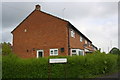
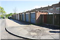
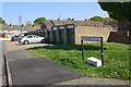
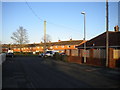
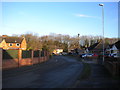
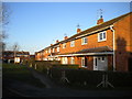
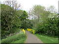
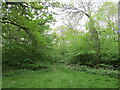
Photos of NN18 0NY


Area Information
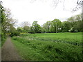
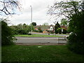
Living in NN18 0NY means inhabiting a compact, densely populated postcode area in Corby, Northamptonshire. This small residential cluster spans just 1.2 hectares, yet accommodates 1,318 residents, translating to a population density of 107,055 people per square kilometre. The area’s history is rooted in Corby’s 1950 designation as a new town, shaped by its industrial past. While the steelworks that once dominated the region have long since closed, the town’s legacy persists in its infrastructure and community character. NN18 0NY is a microcosm of Corby’s present: a place where older residents, many in their 40s and 50s, coexist with a mix of local amenities and transport links. The area’s proximity to Corby Railway Station and the Bus Interchange ensures connectivity, while its small size fosters a sense of familiarity. For buyers, it’s a chance to own a home in a tightly knit, historically significant part of the East Midlands, though the density means space is at a premium.
- Area Type
- Postcode
- Area Size
- 1.2 hectares
- Population
- 1318
- Population Density
- 3377 people/km²
The property market in NN18 0NY is defined by its compact size and the prevalence of houses over flats. With 47% of residents owning their homes, the area is a mix of owner-occupied and rental properties, though the small footprint of the postcode suggests limited housing stock. The dominance of houses implies a focus on family-friendly or traditional living arrangements, potentially appealing to those seeking more space than a flat could offer. However, the area’s small size means buyers must consider proximity to nearby amenities and transport links. Given the high population density, properties here are likely to be smaller and more closely spaced than in surrounding areas. For those prioritising convenience over size, NN18 0NY offers a tightly woven network of homes near essential services, though the limited land area may restrict future development or expansion.
House Prices in NN18 0NY
Showing 36 properties
| Address | Type | Beds | Baths | Last Sale Price | Last Sale Date | |
|---|---|---|---|---|---|---|
| 47 York Road, Corby, NN18 0NY | Terraced | 3 | 1 | £186,000 | Nov 2025 | |
| 23 York Road, Corby, NN18 0NY | house | - | - | £177,500 | Nov 2024 | |
| 46 York Road, Corby, NN18 0NY | Terraced | 3 | 1 | £157,000 | Jul 2021 | |
| 38 York Road, Corby, NN18 0NY | house | - | - | £170,000 | Apr 2021 | |
| 36 York Road, Corby, NN18 0NY | Semi-detached | - | - | £130,000 | Mar 2020 | |
| 32 York Road, Corby, NN18 0NY | Semi-detached | 4 | - | £155,000 | Jul 2018 | |
| 33 York Road, Corby, NN18 0NY | house | - | - | £156,000 | Mar 2017 | |
| 30 York Road, Corby, NN18 0NY | house | - | - | £135,000 | Dec 2015 | |
| 29 York Road, Corby, NN18 0NY | Semi-detached | 4 | 3 | £110,000 | Dec 2014 | |
| 50 York Road, Corby, NN18 0NY | house | - | - | £98,000 | Mar 2013 |
Energy Efficiency in NN18 0NY
Life in NN18 0NY revolves around its proximity to essential amenities, including five retail outlets such as Morrisons Daily Corby, Spar, and other local shops. These provide access to groceries, daily essentials, and convenience services, reducing the need for long commutes. The Corby Railway Station and Bus Interchange are key to the area’s connectivity, enabling easy travel to work, schools, or leisure activities. While the area itself is small, its integration with Corby’s broader infrastructure means residents can access larger retail parks, parks, and cultural sites nearby. The compact nature of NN18 0NY fosters a sense of community, with local shops and transport hubs serving as social and practical anchors. However, the limited size means lifestyle choices are shaped by proximity to these central points rather than a wide array of options.
Amenities
Schools
| Rank | School | Type | Entry gender | Ages |
|---|
Explore more schools in this area
Go to Schools tabDemographics
The population of NN18 0NY is predominantly middle-aged, with a median age of 47 and the most common age range being 30–64 years. This suggests a community of established professionals and families, many of whom may have ties to the region’s industrial past. Home ownership rates stand at 47%, indicating that nearly half of residents rent their homes, while the remaining 53% are likely owner-occupied. The area is characterised by houses rather than flats, reflecting a preference for single-family dwellings. The predominant ethnic group is White, with no specific data provided on minority representation. The high population density—107,055 people per square kilometre—means living spaces are closely packed, which may influence the character of daily life. While this density can create a vibrant, communal atmosphere, it also underscores the limited availability of larger properties or open spaces.
Household Size
Accommodation Type
Tenure
Ethnic Group
Religion
Household Composition
Age
Household Deprivation
NS-SEC
Explore more demographic insights in this area
Go to Demographics tabPlanning
Planning Constraints
- Flood RiskPremium
- Ramsar Wetland SitesPremium
- Area of Outstanding Natural BeautyPremium
- Protected Nature ReservePremium
- Protected WoodlandPremium