Area Overview for NN17 2NG
Photos of NN17 2NG
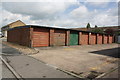
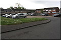
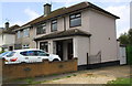
37 photos from this area
Area Information
Key information about the NN17 2NG including its size, population, and administrative classification.
- Area Type
- Postcode
- Area Size
- 8003 m²
- Population
- 1710
- Population Density
- 6105 people/km²
House Prices in NN17 2NG
20
Properties
£163,765
Average Sold Price
£77,000
Lowest Price
£220,000
Highest Price
Showing 20 properties
| Address | Type | Beds | Baths | Last Sale Price | Last Sale Date | |
|---|---|---|---|---|---|---|
| 12 Wordsworth Avenue, Corby, NN17 2NG | Terraced | 4 | 1 | £220,000 | Aug 2024 | |
| 22 Wordsworth Avenue, Corby, NN17 2NG | house | - | - | £195,000 | Nov 2022 | |
| 5 Wordsworth Avenue, Corby, NN17 2NG | Retail | 4 | 1 | £218,000 | Oct 2022 | |
| 14 Wordsworth Avenue, Corby, NN17 2NG | Retail | 3 | 1 | £204,950 | Jun 2022 | |
| 6 Wordsworth Avenue, Corby, NN17 2NG | house | - | - | £200,000 | Oct 2021 | |
| 16 Wordsworth Avenue, Corby, NN17 2NG | house | - | - | £177,000 | Jan 2021 | |
| 24 Wordsworth Avenue, Corby, NN17 2NG | house | - | - | £175,000 | Jun 2019 | |
| 1 Wordsworth Avenue, Corby, NN17 2NG | house | - | - | £135,000 | Nov 2017 | |
| 8 Wordsworth Avenue, Corby, NN17 2NG | house | 3 | 1 | £155,000 | Jul 2017 | |
| 26 Wordsworth Avenue, Corby, NN17 2NG | Semi-detached | 3 | - | £162,000 | Jun 2017 |
Page 1 of 2
Energy Efficiency in NN17 2NG
Amenities
Schools
| Rank | School | Type | Entry gender | Ages |
|---|
Explore more schools in this area
Go to Schools tabDemographics
Household Size
Family (3-5 people)
most common
Accommodation Type
Houses
most common
Tenure
68
majority
Ethnic Group
White
most common
Religion
N/A
most common
Household Composition
N/A
most common
Age
47
median
Adults (30-64 years)
most common
Household Deprivation
N/A
with no deprivation
NS-SEC
21
in Lower managerial occupations
Explore more demographic insights in this area
Go to Demographics tabPlanning
Planning Constraints
- Flood RiskPremium
- Ramsar Wetland SitesPremium
- Area of Outstanding Natural BeautyPremium
- Protected Nature ReservePremium
- Protected WoodlandPremium