Area Overview for NN17 2ND
Photos of NN17 2ND
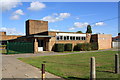
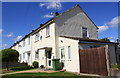
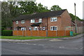
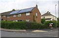
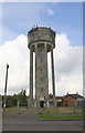
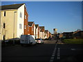
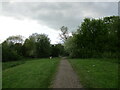
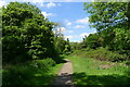
23 photos from this area
Area Information
Key information about the NN17 2ND including its size, population, and administrative classification.
- Area Type
- Postcode
- Area Size
- 1.2 hectares
- Population
- 1710
- Population Density
- 6105 people/km²
House Prices in NN17 2ND
31
Properties
£84,156
Average Sold Price
£23,400
Lowest Price
£204,000
Highest Price
Showing 31 properties
| Address | Type | Beds | Baths | Last Sale Price | Last Sale Date | |
|---|---|---|---|---|---|---|
| 47 Shakespeare Way, Corby, NN17 2ND | Semi-detached | 3 | 1 | £204,000 | Oct 2025 | |
| 49 Shakespeare Way, Corby, NN17 2ND | Semi-detached | 3 | 1 | £180,000 | May 2024 | |
| 44 Shakespeare Way, Corby, NN17 2ND | house | 3 | - | £102,000 | Jul 2019 | |
| 36 Shakespeare Way, Corby, NN17 2ND | Semi-detached | 3 | 1 | £127,500 | Jul 2017 | |
| 54 Shakespeare Way, Corby, NN17 2ND | Semi-detached | 4 | 1 | £119,950 | Mar 2016 | |
| 34 Shakespeare Way, Corby, NN17 2ND | house | - | - | £79,000 | Nov 2012 | |
| 62 Shakespeare Way, Corby, NN17 2ND | Semi-detached | - | - | £55,000 | Sep 2010 | |
| 48 Shakespeare Way, Corby, NN17 2ND | house | - | - | £106,000 | Jan 2007 | |
| 38 Shakespeare Way, Corby, NN17 2ND | Semi-detached | - | - | £95,000 | Sep 2006 | |
| 37 Shakespeare Way, Corby, NN17 2ND | house | - | - | £23,400 | Apr 2003 |
Page 1 of 4
Energy Efficiency in NN17 2ND
Amenities
Schools
| Rank | School | Type | Entry gender | Ages |
|---|
Explore more schools in this area
Go to Schools tabDemographics
Household Size
Family (3-5 people)
most common
Accommodation Type
Houses
most common
Tenure
68
majority
Ethnic Group
White
most common
Religion
N/A
most common
Household Composition
N/A
most common
Age
47
median
Adults (30-64 years)
most common
Household Deprivation
N/A
with no deprivation
NS-SEC
21
in Lower managerial occupations
Explore more demographic insights in this area
Go to Demographics tabPlanning
Planning Constraints
- Flood RiskPremium
- Ramsar Wetland SitesPremium
- Area of Outstanding Natural BeautyPremium
- Protected Nature ReservePremium
- Protected WoodlandPremium