Area Overview for NN17 1DT
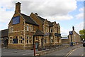
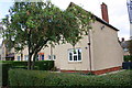
Photos of NN17 1DT


Area Information
Living in NN17 1DT means being part of a compact residential cluster in Corby, Northamptonshire, a town designated a new town in 1950. This postcode covers 1,301 square metres and is home to 1,873 residents, giving it a population density of 620 people per square kilometre. Corby’s history as an industrial hub, shaped by its 1930s steelworks, contrasts with its current character as a residential area with a distinct community feel. The town’s name, derived from the Old English “Kori’s by,” reflects its long-standing settlement. While modern infrastructure dominates, the area retains a connection to its past, with events like the Corby Pole Fair celebrating its 16th-century charter. Daily life here is shaped by proximity to retail, rail, and local schools, with a mix of older and newer housing. The compact size of NN17 1DT means residents are close to amenities, though the area’s small footprint means it is best suited for those prioritising convenience over sprawling landscapes.
- Area Type
- Postcode
- Area Size
- 1301 m²
- Population
- 1873
- Population Density
- 620 people/km²
The property market in NN17 1DT is characterised by a 43% home ownership rate, with houses making up the majority of accommodation types. This suggests a balance between owner-occupied homes and rental properties, though the exact proportion of rentals is not specified. The presence of houses indicates a preference for standalone living, which may appeal to families or individuals seeking privacy. Given the area’s small size, the housing stock is likely limited, with limited scope for new developments. Buyers should consider that the market may be competitive, particularly for properties in good condition. The compact nature of NN17 1DT means that properties are likely close to local amenities, though the lack of detailed data on property prices or trends means buyers must rely on local insights. The mix of home ownership and rental options offers flexibility but may also reflect the area’s modest economic profile.
House Prices in NN17 1DT
Showing 15 properties
| Address | Type | Beds | Baths | Last Sale Price | Last Sale Date | |
|---|---|---|---|---|---|---|
| Flat 3, Stocks Court, Corby, NN17 1DT | Flat | 2 | 2 | £142,850 | Jul 2025 | |
| Flat 7, Stocks Court, Corby, NN17 1DT | Flat | - | - | £134,950 | Dec 2024 | |
| Flat 2, Stocks Court, Corby, NN17 1DT | Flat | - | - | £125,000 | Dec 2023 | |
| Flat 12, Stocks Court, Corby, NN17 1DT | Flat | - | - | £152,000 | Apr 2022 | |
| Flat 11, Stocks Court, Corby, NN17 1DT | Flat | 2 | 1 | £113,000 | Jun 2021 | |
| Flat 5, Stocks Court, Corby, NN17 1DT | Flat | - | - | £119,500 | May 2021 | |
| Flat 10, Stocks Court, Corby, NN17 1DT | Flat | - | - | £104,995 | Apr 2021 | |
| Flat 13, Stocks Court, Corby, NN17 1DT | Flat | - | - | £110,000 | Mar 2020 | |
| Flat 8, Stocks Court, Corby, NN17 1DT | Flat | - | - | £108,000 | Jan 2019 | |
| Flat 1, Stocks Court, Corby, NN17 1DT | Flat | 2 | - | £115,000 | Oct 2018 |
Energy Efficiency in NN17 1DT
Residents of NN17 1DT have access to a range of nearby amenities, including retail outlets such as Iceland Corby, M&S Corby, and Tesco Corby. These stores provide essential shopping and leisure options, ensuring convenience for daily needs. The presence of Corby Railway Station further enhances connectivity, allowing easy access to broader networks. While the area does not list specific parks or leisure facilities, the proximity to Corby’s town centre likely offers additional recreational opportunities. The compact nature of NN17 1DT means that amenities are within practical reach, fostering a sense of community. The mix of retail and transport options supports a balanced lifestyle, though the lack of detailed information on leisure venues means residents may explore beyond the immediate postcode for cultural or recreational activities.
Amenities
Schools
The nearest school to NN17 1DT is Corby Old Village Primary School, which provides education for younger children. Rated “good” by Ofsted, it offers a reliable foundation for primary education. The absence of secondary schools in the immediate vicinity means families may need to look further afield for secondary education, though Corby itself likely has options. The presence of a primary school with a positive rating is a significant draw for families, ensuring accessible early education. However, the data does not specify the number of schools or their proximity, so parents should investigate further for comprehensive schooling. The single primary school in the area may indicate a focus on local community schools rather than larger institutions, which could influence the social dynamics of the neighbourhood.
| Rank | School | Type | Entry gender | Ages |
|---|
Explore more schools in this area
Go to Schools tabDemographics
The community in NN17 1DT is predominantly composed of adults aged 30–64, with a median age of 47. This suggests a mature population, likely with established careers and family structures. Home ownership stands at 43%, indicating a mix of owner-occupied and rental properties. The area’s accommodation is largely houses, reflecting a preference for standalone homes over flats. The predominant ethnic group is White, with no specific data on other demographics. The population density of 620 people per square kilometre implies a moderately sized community, where social interactions are likely frequent. While the data does not specify deprivation levels, the age profile and home ownership rate suggest a stable, working-age population with a focus on long-term residency. This demographic profile may influence local services and amenities, tailored to the needs of families and professionals.
Household Size
Accommodation Type
Tenure
Ethnic Group
Religion
Household Composition
Age
Household Deprivation
NS-SEC
Explore more demographic insights in this area
Go to Demographics tabPlanning
Planning Constraints
- Flood RiskPremium
- Ramsar Wetland SitesPremium
- Area of Outstanding Natural BeautyPremium
- Protected Nature ReservePremium
- Protected WoodlandPremium