Area Overview for NN15 6GE
Photos of NN15 6GE
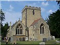
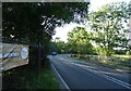

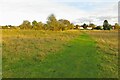
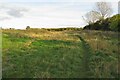
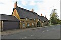
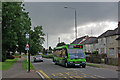
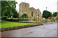
15 photos from this area
Area Information
Key information about the NN15 6GE including its size, population, and administrative classification.
- Area Type
- Postcode
- Area Size
- 1.8 hectares
- Population
- 2395
- Population Density
- 2077 people/km²
House Prices in NN15 6GE
22
Properties
£327,476
Average Sold Price
£173,500
Lowest Price
£560,000
Highest Price
Showing 22 properties
| Address | Type | Beds | Baths | Last Sale Price | Last Sale Date | |
|---|---|---|---|---|---|---|
| 15 Westminster Drive, Barton Seagrave, NN15 6GE | Detached | 4 | 3 | £560,000 | Apr 2022 | |
| 11 Westminster Drive, Barton Seagrave, NN15 6GE | house | 4 | - | £520,000 | Apr 2022 | |
| 16 Westminster Drive, Barton Seagrave, NN15 6GE | Detached | 5 | 3 | £425,000 | Oct 2020 | |
| 8 Westminster Drive, Barton Seagrave, NN15 6GE | Detached | 5 | 3 | £435,000 | Feb 2019 | |
| 6 Westminster Drive, Barton Seagrave, NN15 6GE | Detached | 5 | - | £415,000 | Jan 2019 | |
| 13 Westminster Drive, Barton Seagrave, NN15 6GE | Semi-detached | 5 | - | £505,000 | Jul 2016 | |
| 10 Westminster Drive, Barton Seagrave, NN15 6GE | Detached | 5 | 3 | £350,000 | Mar 2015 | |
| 4 Westminster Drive, Barton Seagrave, NN15 6GE | house | - | - | £276,000 | Sep 2013 | |
| 22 Westminster Drive, Barton Seagrave, NN15 6GE | house | - | - | £309,000 | Apr 2012 | |
| 17 Westminster Drive, Barton Seagrave, NN15 6GE | house | - | - | £355,000 | Jun 2009 |
Page 1 of 3
Energy Efficiency in NN15 6GE
Amenities
Schools
| Rank | School | Type | Entry gender | Ages |
|---|
Explore more schools in this area
Go to Schools tabDemographics
Household Size
Family (3-5 people)
most common
Accommodation Type
Houses
most common
Tenure
91
majority
Ethnic Group
White
most common
Religion
N/A
most common
Household Composition
N/A
most common
Age
47
median
Adults (30-64 years)
most common
Household Deprivation
N/A
with no deprivation
NS-SEC
45
in Lower managerial occupations
Explore more demographic insights in this area
Go to Demographics tabPlanning
Planning Constraints
- Flood RiskPremium
- Ramsar Wetland SitesPremium
- Area of Outstanding Natural BeautyPremium
- Protected Nature ReservePremium
- Protected WoodlandPremium