Area Overview for NN15 6DJ
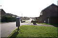
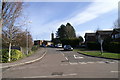
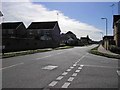
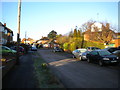
Photos of NN15 6DJ


Area Information
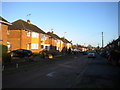
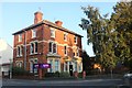
NN15 6DJ represents a specific residential cluster within Kettering, a historic market town in Northamptonshire. This postcode covers an area of 3,451 square metres and houses a population of 2,263 people. The location is situated approximately eight miles north of Wellingborough and seventy-five miles from London, placing it in the East Midlands region of England. Living in NN15 6DJ means residing in a community with deep historical roots, documented since 956 AD when King Edwy granted land to Ælfsige the Goldsmith. The town transformed from a modest medieval settlement into a substantial industrial centre during the nineteenth century, driven significantly by the shoe-making enterprise founded by Thomas Gotch in 1778. The area stands around the corner of the parish church of St Peter and St Paul, whose distinctive crocketed spire dominates the skyline near the Market Square. Daily life here involves a connection to a place where the opening of Kettering Railway Station in 1857 provided crucial economic stimulus after being linked to London in 1867. You will find yourself in a setting that blends heritage with modern utility, anchored by a strong sense of local identity. Homes in NN15 6DJ offer access to a community that retains its early industrial character while benefiting from a town charter granted by King Henry III in 1227. Individual properties provide a direct line to a neighbourhood defined by centuries of trade, from woollen manufacturing in the cloth age to the boot and shoe dominance of the nineteenth century.
- Area Type
- Postcode
- Area Size
- 3451 m²
- Population
- 2263
- Population Density
- 5126 people/km²
The property market in NN15 6DJ is defined by its focus on owned homes rather than rental stock. Houses make up the predominant accommodation type, confirming that the housing stock is primarily structural rather than flats or apartments. With a 56% home ownership rate, you are looking at an area where the majority of residents are owner-occupiers. This statistic signals a market where buyers have invested locally, creating a sense of permanence often associated with family homes. The small area size of 3,451 square metres indicates a tight cluster of properties, likely increasing competition for available sales. For buyers considering homes in NN15 6DJ, the predominance of houses means you can expect traditional property layouts typical of Northamptonshire market towns. Independent sellers usually face different viewing dynamics compared to high-density councils estates. High home ownership suggests that when properties do come to market, they often undergo maintenance consistent with owner-operator pride. The area does not include significant blocks of apartments, which aligns with the historical development patterns of Kettering. You are entering a market where equity building is the primary motivation for most transactions. This environment suits those seeking space and stability over the communal living found in high-rise developments.
House Prices in NN15 6DJ
No properties found in this postcode.
Energy Efficiency in NN15 6DJ
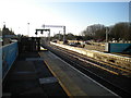
Residents of NN15 6DJ enjoy convenient access to a variety of amenities within practical reach. Your shopping routine can be managed with visits to Tesco Kettering, Co-op Kettering, and Lidl Weekley. These three retailers provide a solid selection of groceries and household essentials without requiring long trips. There are five retail locations identified in the immediate vicinity, ensuring that basic needs are easily met. For travel needs, Kettering Railway Station is available one rail stop away, while the Bus Interchange is the designated point for bus travel. The lifestyle in NN15 6DJ is supported by the broader historical context of Kettering, a town named after Anglo-Saxon origins meaning "the people of Ketter". You live in a neighbourhood where markets were established in 1227. The proximity to the town centre allows you to use historic venues like the Sawyer family's Manor House, now a museum, for local events. The parish church of St Peter and St Paul sits in the Market Square, offering a community focal point. Kettering's history as a centre of iron-smelting and boot manufacturing shapes the local character. Living in NN15 6DJ combines modern convenience with the charm of a town shaped by King Henry III's market charter from the twelfth century.
Amenities
Schools
Families moving to NN15 6DJ have two clear school options nearby. Hawthorn Community Primary School is a state primary school located close to the residential cluster. Currently, the school holds an Ofsted rating of "good". This positive assessment provides reassurance regarding educational standards. St Peter's School operates as an independent institution, offering a private education alternative to the state system. The availability of both state and independent options gives parents flexibility in choosing an educational path for their children. Most pupils will attend Hawthorn Community Primary School to receive their primary education. The presence of St Peter's School caters to families seeking a different curriculum or faith-based education. Living in NN15 6DJ places children within practical reach of these institutions. The mix of school types means you have access to comprehensive education without needing to travel far. Parents can weigh the benefits of the "good" rated state sector against the independence of the private sector for their youngest children. The distance to these schools remains minimal, ensuring that daily commutes are shorter than in outer suburban areas.
| Rank | School | Type | Entry gender | Ages |
|---|
Explore more schools in this area
Go to Schools tabDemographics
The community in NN15 6DJ reflects a stable, established population profile. The median age for residents is 47, with adults aged between 30 and 64 years comprising the most common age range. This demographic skew suggests a neighbourhood where families and professionals with secure careers have put down significant roots. Home ownership stands at 56%, indicating that more than half of the residents are likely mortgage-free or paying off their loans over a long tenure. The predominant accommodation type consists of houses, which aligns with the choice made by the majority of equity holders. The area is demographically diverse, though White British residents form the predominant ethnic group. You are buying into a settled environment where the average resident has likely lived in the area for a considerable period. The population density is calculated based on the small total area size of 3,451 square metres, creating a compact feel despite the low total population count of 2,263. Living in NN15 6DJ means joining a demographic where the adult workforce is the primary driver of the local economy and social fabric. The lack of significant younger children or elderly isolates the community slightly from the very young or the very old, creating a specific dynamic among house buyers. This age structure supports stable neighbourhoods where long-term investments are common. Every household is part of a cluster where the typical resident is a working adult managing a family or single-person household.
Household Size
Accommodation Type
Tenure
Ethnic Group
Religion
Household Composition
Age
Household Deprivation
NS-SEC
Explore more demographic insights in this area
Go to Demographics tabPlanning
Planning Constraints
- Flood RiskPremium
- Ramsar Wetland SitesPremium
- Area of Outstanding Natural BeautyPremium
- Protected Nature ReservePremium
- Protected WoodlandPremium