Area Overview for NN15 5DR
Photos of NN15 5DR
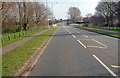
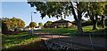
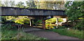
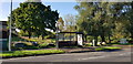
6 photos from this area
Area Information
Key information about the NN15 5DR including its size, population, and administrative classification.
- Area Type
- Postcode
- Area Size
- 1.9 hectares
- Population
- 1523
- Population Density
- 1372 people/km²
House Prices in NN15 5DR
52
Properties
£156,377
Average Sold Price
£38,250
Lowest Price
£445,000
Highest Price
Showing 52 properties
| Address | Type | Beds | Baths | Last Sale Price | Last Sale Date | |
|---|---|---|---|---|---|---|
| 19 St Vincents Avenue, Kettering, NN15 5DR | Detached | 2 | 1 | £215,000 | Oct 2025 | |
| 39 St Vincents Avenue, Kettering, NN15 5DR | house | 3 | 1 | £249,000 | Dec 2024 | |
| 27 St Vincents Avenue, Kettering, NN15 5DR | house | - | - | £205,000 | Nov 2023 | |
| 7 St Vincents Avenue, Kettering, NN15 5DR | house | 3 | 3 | £317,500 | Aug 2023 | |
| 29 St Vincents Avenue, Kettering, NN15 5DR | house | - | - | £220,000 | Mar 2023 | |
| 65 St Vincents Avenue, Kettering, NN15 5DR | Terraced | 2 | 1 | £225,000 | Dec 2022 | |
| 49 St Vincents Avenue, Kettering, NN15 5DR | Detached | 2 | 1 | £207,500 | Aug 2021 | |
| 36 St Vincents Avenue, Kettering, NN15 5DR | Detached | 4 | 2 | £326,100 | Aug 2021 | |
| 51 St Vincents Avenue, Kettering, NN15 5DR | house | - | - | £189,950 | Aug 2021 | |
| 41 St Vincents Avenue, Kettering, NN15 5DR | house | - | - | £135,000 | Feb 2020 |
Page 1 of 6
Energy Efficiency in NN15 5DR
Amenities
Schools
| Rank | School | Type | Entry gender | Ages |
|---|
Explore more schools in this area
Go to Schools tabDemographics
Household Size
Two person
most common
Accommodation Type
Houses
most common
Tenure
79
majority
Ethnic Group
White
most common
Religion
N/A
most common
Household Composition
N/A
most common
Age
47
median
Adults (30-64 years)
most common
Household Deprivation
N/A
with no deprivation
NS-SEC
30
in Lower managerial occupations
Explore more demographic insights in this area
Go to Demographics tabPlanning
Planning Constraints
- Flood RiskPremium
- Ramsar Wetland SitesPremium
- Area of Outstanding Natural BeautyPremium
- Protected Nature ReservePremium
- Protected WoodlandPremium