Area Overview for NN14 4JS
Photos of NN14 4JS
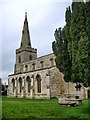

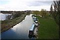
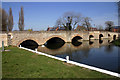
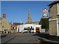
81 photos from this area
Area Information
Key information about the NN14 4JS including its size, population, and administrative classification.
- Area Type
- Postcode
- Area Size
- 2.3 hectares
- Population
- 1537
- Population Density
- 3957 people/km²
House Prices in NN14 4JS
60
Properties
£232,868
Average Sold Price
£23,000
Lowest Price
£499,999
Highest Price
Showing 60 properties
| Address | Type | Beds | Baths | Last Sale Price | Last Sale Date | |
|---|---|---|---|---|---|---|
| 9 Midland Road, Thrapston, NN14 4JS | Terraced | 2 | 1 | £235,000 | Sep 2025 | |
| 17A Midland Road, Thrapston, NN14 4JS | Maisonette | 2 | - | £109,999 | Jul 2025 | |
| 73 Midland Road, Thrapston, NN14 4JS | Terraced | 3 | - | £160,000 | Jul 2025 | |
| 63 Midland Road, Thrapston, NN14 4JS | Terraced | 3 | 2 | £322,500 | May 2025 | |
| 105 Midland Road, Thrapston, NN14 4JS | Semi-detached | 4 | 2 | £300,000 | Nov 2024 | |
| 83C Midland Road, Thrapston, NN14 4JS | Detached | 4 | 3 | £445,000 | Jun 2024 | |
| 47 Midland Road, Thrapston, NN14 4JS | house | 3 | 1 | £230,000 | Jul 2023 | |
| 19 Midland Road, Thrapston, NN14 4JS | house | - | - | £215,000 | Jun 2023 | |
| 111 Midland Road, Thrapston, NN14 4JS | Semi-detached | 3 | 1 | £352,000 | Jul 2022 | |
| 37 Midland Road, Thrapston, NN14 4JS | Semi-detached | 3 | 1 | £480,000 | Jul 2022 |
Page 1 of 6
Energy Efficiency in NN14 4JS
Amenities
Schools
| Rank | School | Type | Entry gender | Ages |
|---|
Explore more schools in this area
Go to Schools tabDemographics
Household Size
Family (3-5 people)
most common
Accommodation Type
Houses
most common
Tenure
76
majority
Ethnic Group
White
most common
Religion
N/A
most common
Household Composition
N/A
most common
Age
47
median
Adults (30-64 years)
most common
Household Deprivation
N/A
with no deprivation
NS-SEC
42
in Lower managerial occupations
Explore more demographic insights in this area
Go to Demographics tabPlanning
Planning Constraints
- Flood RiskPremium
- Ramsar Wetland SitesPremium
- Area of Outstanding Natural BeautyPremium
- Protected Nature ReservePremium
- Protected WoodlandPremium