Area Overview for NN14 4JH
Photos of NN14 4JH
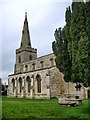
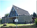
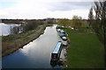
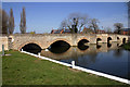
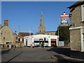
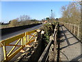
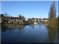
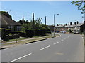
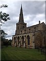
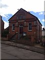
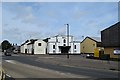
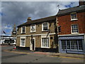
81 photos from this area
Area Information
Key information about the NN14 4JH including its size, population, and administrative classification.
- Area Type
- Postcode
- Area Size
- 1.1 hectares
- Population
- 2188
- Population Density
- 2297 people/km²
House Prices in NN14 4JH
35
Properties
£99,500
Average Sold Price
£38,500
Lowest Price
£200,000
Highest Price
Showing 35 properties
| Address | Type | Beds | Baths | Last Sale Price | Last Sale Date | |
|---|---|---|---|---|---|---|
| 44A High Street, Thrapston, NN14 4JH | Maisonette | - | - | £38,500 | Jun 2001 | |
| 64C High Street, Thrapston, NN14 4JH | house | - | - | £60,000 | Dec 1998 | |
| The Old Rectory, 78 High Street, Thrapston, NN14 4JH | Retail | 3 | - | £200,000 | Jan 1998 | |
| 34B High Street, Thrapston, NN14 4JH | Retail | - | - | - | - | |
| 16A High Street, Thrapston, NN14 4JH | Flat | - | - | - | - | |
| 62A High Street, Thrapston, NN14 4JH | Flat | 2 | 2 | - | - | |
| 64A High Street, Thrapston, NN14 4JH | Flat | 3 | - | - | - | |
| Second Floor Front Flat, 66A High Street, Thrapston, NN14 4JH | Flat | - | - | - | - | |
| Second Floor Rear Flat, 66A High Street, Thrapston, NN14 4JH | Flat | - | - | - | - | |
| First Floor Rear Flat, 66A High Street, Thrapston, NN14 4JH | Flat | - | - | - | - |
Page 1 of 4
Energy Efficiency in NN14 4JH
Amenities
Schools
| Rank | School | Type | Entry gender | Ages |
|---|
Explore more schools in this area
Go to Schools tabDemographics
Household Size
Two person
most common
Accommodation Type
Houses
most common
Tenure
63
majority
Ethnic Group
White
most common
Religion
N/A
most common
Household Composition
N/A
most common
Age
47
median
Adults (30-64 years)
most common
Household Deprivation
N/A
with no deprivation
NS-SEC
32
in Lower managerial occupations
Explore more demographic insights in this area
Go to Demographics tabPlanning
Planning Constraints
- Flood RiskPremium
- Ramsar Wetland SitesPremium
- Area of Outstanding Natural BeautyPremium
- Protected Nature ReservePremium
- Protected WoodlandPremium