Area Overview for NN10 9NZ
Photos of NN10 9NZ
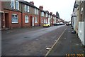
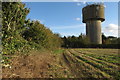
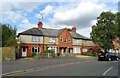
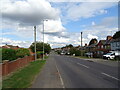
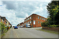
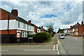
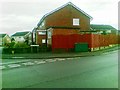
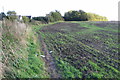
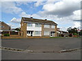
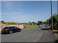
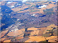
12 photos from this area
Area Information
Key information about the NN10 9NZ including its size, population, and administrative classification.
- Area Type
- Postcode
- Area Size
- 9878 m²
- Population
- 2059
- Population Density
- 5480 people/km²
House Prices in NN10 9NZ
27
Properties
£185,525
Average Sold Price
£27,250
Lowest Price
£320,000
Highest Price
Showing 27 properties
| Address | Type | Beds | Baths | Last Sale Price | Last Sale Date | |
|---|---|---|---|---|---|---|
| 8 Hillary Road, Rushden, NN10 9NZ | Semi-detached | 4 | 1 | £320,000 | Apr 2025 | |
| 9 Hillary Road, Rushden, NN10 9NZ | Semi-detached | 3 | 1 | £280,000 | Mar 2025 | |
| 11 Hillary Road, Rushden, NN10 9NZ | Semi-detached | - | - | £250,000 | Sep 2022 | |
| 20 Hillary Road, Rushden, NN10 9NZ | Semi-detached | 3 | 1 | £236,500 | Apr 2021 | |
| 19 Hillary Road, Rushden, NN10 9NZ | Semi-detached | 3 | 2 | £215,000 | Oct 2020 | |
| 18 Hillary Road, Rushden, NN10 9NZ | Semi-detached | 3 | 1 | £234,995 | Nov 2017 | |
| 5 Hillary Road, Rushden, NN10 9NZ | Semi-detached | 3 | 1 | £235,000 | Sep 2017 | |
| 14 Hillary Road, Rushden, NN10 9NZ | house | - | - | £186,100 | Mar 2017 | |
| 25 Hillary Road, Rushden, NN10 9NZ | Semi-detached | 3 | - | £155,000 | Mar 2015 | |
| 2 Hillary Road, Rushden, NN10 9NZ | Semi-detached | - | - | £169,000 | Mar 2006 |
Page 1 of 3
Energy Efficiency in NN10 9NZ
Amenities
Schools
| Rank | School | Type | Entry gender | Ages |
|---|
Explore more schools in this area
Go to Schools tabDemographics
Household Size
Two person
most common
Accommodation Type
Houses
most common
Tenure
71
majority
Ethnic Group
White
most common
Religion
N/A
most common
Household Composition
N/A
most common
Age
47
median
Adults (30-64 years)
most common
Household Deprivation
N/A
with no deprivation
NS-SEC
25
in Lower managerial occupations
Explore more demographic insights in this area
Go to Demographics tabPlanning
Planning Constraints
- Flood RiskPremium
- Ramsar Wetland SitesPremium
- Area of Outstanding Natural BeautyPremium
- Protected Nature ReservePremium
- Protected WoodlandPremium