Area Overview for NN10 9PW
Photos of NN10 9PW
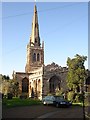

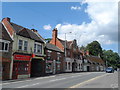

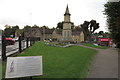

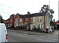
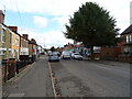
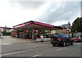

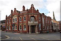

29 photos from this area
Area Information
Key information about the NN10 9PW including its size, population, and administrative classification.
- Area Type
- Postcode
- Area Size
- 2.3 hectares
- Population
- 2059
- Population Density
- 5480 people/km²
House Prices in NN10 9PW
51
Properties
£156,207
Average Sold Price
£38,000
Lowest Price
£300,000
Highest Price
Showing 51 properties
| Address | Type | Beds | Baths | Last Sale Price | Last Sale Date | |
|---|---|---|---|---|---|---|
| 112 St Margarets Avenue, Rushden, NN10 9PW | Semi-detached | 2 | 1 | £235,000 | Mar 2025 | |
| 132 St Margarets Avenue, Rushden, NN10 9PW | Detached | 3 | 2 | £215,000 | Feb 2025 | |
| 102 St Margarets Avenue, Rushden, NN10 9PW | Semi-detached | 2 | 1 | £240,000 | Feb 2025 | |
| 127 St Margarets Avenue, Rushden, NN10 9PW | Semi-detached | 2 | 1 | £300,000 | May 2024 | |
| 113 St Margarets Avenue, Rushden, NN10 9PW | Bungalow | 3 | 1 | £212,500 | Oct 2023 | |
| 145 St Margarets Avenue, Rushden, NN10 9PW | Semi-detached | 2 | 1 | £219,000 | Apr 2023 | |
| 108 St Margarets Avenue, Rushden, NN10 9PW | Semi-detached | 3 | 1 | £151,000 | Mar 2023 | |
| 119 St Margarets Avenue, Rushden, NN10 9PW | Bungalow | 2 | 1 | £234,000 | May 2022 | |
| 147 St Margarets Avenue, Rushden, NN10 9PW | house | - | - | £230,000 | Sep 2021 | |
| 139 St Margarets Avenue, Rushden, NN10 9PW | Bungalow | - | - | £205,000 | Jun 2021 |
Page 1 of 6
Energy Efficiency in NN10 9PW
Amenities
Schools
| Rank | School | Type | Entry gender | Ages |
|---|
Explore more schools in this area
Go to Schools tabDemographics
Household Size
Two person
most common
Accommodation Type
Houses
most common
Tenure
71
majority
Ethnic Group
White
most common
Religion
N/A
most common
Household Composition
N/A
most common
Age
47
median
Adults (30-64 years)
most common
Household Deprivation
N/A
with no deprivation
NS-SEC
25
in Lower managerial occupations
Explore more demographic insights in this area
Go to Demographics tabPlanning
Planning Constraints
- Flood RiskPremium
- Ramsar Wetland SitesPremium
- Area of Outstanding Natural BeautyPremium
- Protected Nature ReservePremium
- Protected WoodlandPremium