Area Overview for NG9 3PH
Photos of NG9 3PH
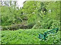
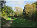
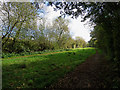

46 photos from this area
Area Information
Key information about the NG9 3PH including its size, population, and administrative classification.
- Area Type
- Postcode
- Area Size
- 11.4 hectares
- Population
- 2287
- Population Density
- 349 people/km²
House Prices in NG9 3PH
22
Properties
£166,093
Average Sold Price
£54,000
Lowest Price
£269,950
Highest Price
Showing 22 properties
| Address | Type | Beds | Baths | Last Sale Price | Last Sale Date | |
|---|---|---|---|---|---|---|
| 10 Ellesmere Drive, Trowell, NG9 3PH | Detached | 3 | 2 | £269,950 | Aug 2019 | |
| 12 Ellesmere Drive, Trowell, NG9 3PH | Semi-detached | 3 | 3 | £219,950 | Jun 2018 | |
| 15 Ellesmere Drive, Trowell, NG9 3PH | Semi-detached | 3 | 1 | £222,500 | Feb 2018 | |
| 21 Ellesmere Drive, Trowell, NG9 3PH | Semi-detached | 3 | 1 | £195,000 | Nov 2017 | |
| 25 Ellesmere Drive, Trowell, NG9 3PH | Semi-detached | 3 | 1 | £183,500 | Jan 2016 | |
| 18 Ellesmere Drive, Trowell, NG9 3PH | Semi-detached | 5 | 2 | £178,000 | Mar 2015 | |
| 8 Ellesmere Drive, Trowell, NG9 3PH | Detached | 4 | 2 | £168,000 | Jun 2013 | |
| 1 Ellesmere Drive, Trowell, NG9 3PH | house | 3 | - | £160,000 | Mar 2011 | |
| 14 Ellesmere Drive, Trowell, NG9 3PH | Semi-detached | - | - | £165,000 | Jul 2008 | |
| 6 Ellesmere Drive, Trowell, NG9 3PH | Semi-detached | - | - | £180,000 | Jun 2007 |
Page 1 of 3
Energy Efficiency in NG9 3PH
Amenities
Schools
| Rank | School | Type | Entry gender | Ages |
|---|
Explore more schools in this area
Go to Schools tabDemographics
Household Size
Two person
most common
Accommodation Type
Houses
most common
Tenure
89
majority
Ethnic Group
White
most common
Religion
N/A
most common
Household Composition
N/A
most common
Age
47
median
Adults (30-64 years)
most common
Household Deprivation
N/A
with no deprivation
NS-SEC
35
in Lower managerial occupations
Explore more demographic insights in this area
Go to Demographics tabPlanning
Planning Constraints
- Flood RiskPremium
- Ramsar Wetland SitesPremium
- Area of Outstanding Natural BeautyPremium
- Protected Nature ReservePremium
- Protected WoodlandPremium