Area Overview for NG9 2LT
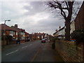
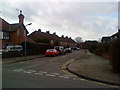
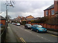
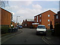
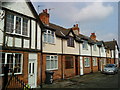
Photos of NG9 2LT


Area Information
Living in NG9 2LT means residing in a compact residential cluster of 6919 square metres in Nottinghamshire. This specific postcode area accommodates 1641 people within a tight-knit environment. The high population density suggests a neighbourhood where spaces are efficiently used and residents likely encounter one another frequently in shared community areas. You move into homes here, knowing you are part of a small, defined group rather than a sprawling suburb. The area functions as a distinct postcode zone covering a small residential cluster, offering a specific slice of life near Nottingham. Residents enjoy close proximity to major transport hubs like Beeston Centre Tram Stop and Beeston Railway Station while remaining in a defined bubble. Daily life here involves navigating a singular, concentrated neighbourhood where every street connects directly to the wider network. You are situated in an area where the immediate surroundings dictate your routine, with essential services just a short walk or bus ride away. The location provides a focused residential experience without the sprawl of larger boroughs.
- Area Type
- Postcode
- Area Size
- 6919 m²
- Population
- 1641
- Population Density
- 5861 people/km²
Homes in NG9 2LT are almost exclusively houses, defining the housing stock you would encounter if searching properties here. The area does not feature any shared-ownership blocks or high-rise flats, which limits your options to detached, semi-detached, or terraced houses depending on the specific street layout. With only 40% of properties owner-occupied, there is a notable presence of private renters alongside homeowners. The market dynamics in this small cluster are driven by families and individuals seeking standalone housing rather than communal apartment living. You are looking at a stock where space is prioritised over density, though the overall area size of 6919 square metres keeps developments intimate. Buying here means entering a market where inventory is finite due to the constrained geographical footprint. The mix of owners and tenants suggests a balanced market where prices reflect the desire for standalone homes in a prime Nottingham location.
House Prices in NG9 2LT
Showing 27 properties
| Address | Type | Beds | Baths | Last Sale Price | Last Sale Date | |
|---|---|---|---|---|---|---|
| 5 Willoughby Street, Beeston, NG9 2LT | house | 2 | 1 | £115,000 | Sep 2025 | |
| 11A Willoughby Street, Beeston, NG9 2LT | Detached | 2 | 1 | £205,000 | Aug 2025 | |
| 3 Willoughby Street, Beeston, NG9 2LT | Semi-detached | 2 | 1 | £185,000 | Apr 2024 | |
| 11 Willoughby Street, Beeston, NG9 2LT | Semi-detached | 2 | 1 | £177,000 | Feb 2021 | |
| 1C Willoughby Street, Beeston, NG9 2LT | Terraced | 2 | 1 | £155,000 | Sep 2019 | |
| 1B Willoughby Street, Beeston, NG9 2LT | Semi-detached | 2 | 1 | £155,000 | Aug 2019 | |
| 1D Willoughby Street, Beeston, NG9 2LT | Terraced | 2 | 1 | £145,840 | Aug 2018 | |
| 22 Willoughby Street, Beeston, NG9 2LT | house | 2 | - | £100,000 | Feb 2013 | |
| 20 Willoughby Street, Beeston, NG9 2LT | house | - | - | £100,000 | Feb 2013 | |
| 24 Willoughby Street, Beeston, NG9 2LT | house | - | - | £90,000 | Nov 2010 |
Energy Efficiency in NG9 2LT
Your daily life in NG9 2LT is defined by exceptional access to retail outlets and transport interchange points. Tesco Nottingham, Sainsburys Beeston, and Lidl Beeston form a potent trio of supermarkets within practical reach, allowing you to stock up on groceries without needing a long journey. You are also close to five metro options, including the Beeston Centre Tram Stop and Middle Street, which simplify your travels across the city without necessarily requiring a car. Five railway stations sit nearby, with Beeston Railway Station and Attenborough Railway Station offering frequent departures to Nottingham and beyond. Nottingham Airport provides regional air travel options if you require it. The nearby amenities include five retail units and five metro connections, creating a convenient environment where errands are quick and easy. Dining and leisure options are accessible just minutes away, ensuring you rarely feel isolated from the broader city hub.
Amenities
Schools
| Rank | School | Type | Entry gender | Ages |
|---|
Explore more schools in this area
Go to Schools tabDemographics
The community in NG9 2LT reflects a mature demographic profile centred on adults between 30 and 64 years old. The median age for residents is 47, indicating a population settled enough to own property but young enough to remain active in careers and local governance. You are surrounded by a community where the majority of the population falls within the 30 to 64 age range, suggesting stability and established households. Home ownership stands at 40%, meaning a significant portion of residents have secured mortgage-free living or own their homes outright. This level of ownership contrasts with areas dominated by social renting, pointing toward a market heavily influenced by private buyers. The accommodation type is exclusively houses, removing the option of flat living from your immediate choices. While White residents form the predominant ethnic group, the area stands as a typical example of established suburban housing in the UK. The social fabric is built around long-term residents who have rooted themselves in this specific postcode.
Household Size
Accommodation Type
Tenure
Ethnic Group
Religion
Household Composition
Age
Household Deprivation
NS-SEC
Explore more demographic insights in this area
Go to Demographics tabPlanning
Planning Constraints
- Flood RiskPremium
- Ramsar Wetland SitesPremium
- Area of Outstanding Natural BeautyPremium
- Protected Nature ReservePremium
- Protected WoodlandPremium