Area Overview for NG9 2LS
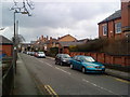
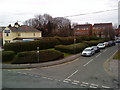
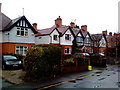
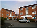
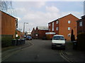
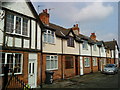
Photos of NG9 2LS

Area Information
Living in NG9 2LS means residing within a specific postcode cluster defined by a residential footprint of just 2148 square metres. This small area contains a population of 1641 individuals, creating a tightly knit environment where neighbours are likely to know one another. The demographic profile is dominated by adults aged between 30 and 64 years, with a median age of 47 years. This indicates a neighbourhood primarily inhabited by households in the middle and later stages of life rather than families with young children or single people entering the market. The character of the area is shaped by these settled residents who inhabit a space designed mainly for houses. Daily life here relies heavily on proximity, as the entire community fits within a compact boundary. While the area lacks the sprawl of larger suburbs, this density supports a sense of stability. However, the high population density figure suggests a very concentrated living situation within this small land area. Prospective buyers should understand that this is a mature settlement rather than a developing frontier, offering a contained environment with established rhythms.
- Area Type
- Postcode
- Area Size
- 2148 m²
- Population
- 1641
- Population Density
- 5861 people/km²
Homes in NG9 2LS are characterised by a specific accommodation type and a balanced ownership model. The area is exclusively composed of houses, meaning buyers will not find flats or high-rise apartments within this postcode. This housing style suits the median age of 47 years, catering to families and older couples who prefer ground access and private gardens over communal buildings. Ownership stands at 40%, which places NG9 2LS in a middle ground between a purely owner-occupied district and a rental-dominated zone. Nearly two-thirds of the population rents, indicating a potentially high volume of the local rental market existing within this small cluster. For a buyer looking to purchase, the prevalence of houses means the local stock is uniform in structure but varied in condition and price. The compact size of the area, covering only 2148 square metres, means properties are likely close to one another. This density ensures that you are buying into a defined, enclosed residential pocket rather than a sprawling suburb.
House Prices in NG9 2LS
Showing 17 properties
| Address | Type | Beds | Baths | Last Sale Price | Last Sale Date | |
|---|---|---|---|---|---|---|
| 2 Clifton Street, Beeston, NG9 2LS | Terraced | 2 | 1 | £228,000 | Feb 2025 | |
| 24 Clifton Street, Beeston, NG9 2LS | Terraced | 3 | 1 | £218,000 | Apr 2023 | |
| 6 Clifton Street, Beeston, NG9 2LS | house | 3 | 1 | £267,000 | Aug 2022 | |
| 10 Clifton Street, Beeston, NG9 2LS | house | 4 | 4 | £150,000 | Feb 2018 | |
| 8 Clifton Street, Beeston, NG9 2LS | Terraced | 3 | 1 | £147,500 | Jun 2016 | |
| 26 Clifton Street, Beeston, NG9 2LS | Terraced | 3 | 1 | £112,500 | Dec 2013 | |
| 6A Clifton Street, Beeston, NG9 2LS | Terraced | 2 | 1 | £105,000 | Mar 2013 | |
| 4 Clifton Street, Beeston, NG9 2LS | Terraced | 1 | 1 | £148,000 | Oct 2010 | |
| 2A Clifton Street, Beeston, NG9 2LS | Terraced | 1 | 1 | £129,000 | Nov 2009 | |
| 16 Clifton Street, Beeston, NG9 2LS | house | - | - | £148,500 | Nov 2006 |
Energy Efficiency in NG9 2LS
Residents of NG9 2LS enjoy immediate access to a range of practical amenities, ensuring daily needs are met without extensive travel. For shopping, five retail outlets are nearby, including Tesco Nottingham, Sainsburys Beeston, and Lidl Beeston. These supermarkets and convenience stores support the daily routine of the local population, allowing you to stock up on groceries at short notice. Five metro points, such as the Middle Street Bus and Tram Interchange, offer public transport options that feed into the wider city network. Beyond essentials, cultural and leisure options are accessible through five notable venues linked to the transport network, including the Beeston Centre Tram Stop. Five rail stations, led by Beeston, Attenborough, and Nottingham, provide broader mobility. One airport, Nottingham Airport, sits within reach for travellers. While the area is dense, these fifty analysed locations split into five distinct categories ensure a service-rich environment. You can access top-tier supermarkets and public transport links while remaining in a residential zone. This balance between quiet living and convenient access to Beeston Centre and nearby rail hubs defines the lifestyle here.
Amenities
Schools
| Rank | School | Type | Entry gender | Ages |
|---|
Explore more schools in this area
Go to Schools tabDemographics
The community structure in NG9 2LS is defined by specific ownership patterns and age demographics. Approximately 40% of residents own their homes outright or with a mortgage, while the remaining 60% reside in rental accommodation. This split suggests a mixed market where neither owner-occupiers nor tenants form an absolute majority. The housing stock consists almost exclusively of houses, aligning with the preference of the local age group. Age distribution shows a clear concentration in the 30 to 64-year-old bracket. The median age of 47 years confirms that this is not a youth-oriented zone but one built for established adults. The predominant ethnic group is White, reflecting the broader historical settlement of the region. With a population of 1641 people squeezed into such a small geographical area, the social fabric remains close. Living in NG9 2LS offers a setting where the majority of residents are likely over thirty, providing a stable social environment without the volatile fluctuations often seen in student-heavy or retirement-only zones.
Household Size
Accommodation Type
Tenure
Ethnic Group
Religion
Household Composition
Age
Household Deprivation
NS-SEC
Explore more demographic insights in this area
Go to Demographics tabPlanning
Planning Constraints
- Flood RiskPremium
- Ramsar Wetland SitesPremium
- Area of Outstanding Natural BeautyPremium
- Protected Nature ReservePremium
- Protected WoodlandPremium