Area Overview for NG9 2HR
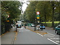
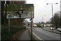
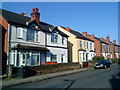
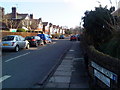
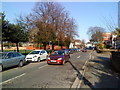
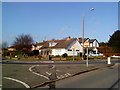
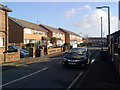
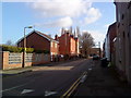
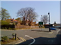
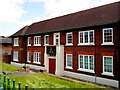
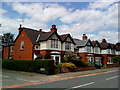
Photos of NG9 2HR
Area Information
Living in NG9 2HR offers a highly concentrated residential experience within a tightly defined boundary. This specific postcode covers a small cluster measuring just 6,837 square metres, hosting a population of 2,006 people. The density is exceptionally high, reaching 293,402 people per square kilometre, which creates an intense living environment. You will find yourself in a compact neighbourhood where every street corner holds several neighbours. Daily life revolves around close proximity to others and immediate access to services. The area functions as a focused residential hub rather than a sprawling suburb. Its small size means you can walk to most necessary amenities quickly. There are no vast open spaces within these specific boundaries, but the location provides essential convenience. This makes NG9 2HR suitable for those who value immediate accessibility over spacious surroundings. You are situated in a place where community interaction is often unavoidable due to the sheer closeness of every household.
- Area Type
- Postcode
- Area Size
- 6837 m²
- Population
- 2006
- Population Density
- 8864 people/km²
The property market in NG9 2HR is defined by a strong owner-occupier culture set within a dense housing stock. You will find that 56% of the residents own their homes, indicating a stable neighbourhood where many people have committed to staying long term. The predominant accommodation type is houses, which aligns with the trend of ownership and family formation within this postcode. This distribution suggests a market where buyers seek traditional housing solutions rather than purpose-built flats or shared flats. Given the small total area size of 6,837 square metres, the selection of properties will be limited, necessitating movement to adjacent areas for more choices. However, the local cluster offers a concentrated experience of house living. This environment is likely more expensive per square metre due to the high population density of 293,402 people per square kilometre. Buyers should expect a competitive market focused on existing houses rather than new developments. The high ownership rate signals a mature market where property values remain stable and transactions are straightforward.
House Prices in NG9 2HR
Showing 19 properties
| Address | Type | Beds | Baths | Last Sale Price | Last Sale Date | |
|---|---|---|---|---|---|---|
| 35 Kenilworth Road, Beeston, NG9 2HR | Semi-detached | 3 | 1 | £310,000 | Oct 2024 | |
| 51 Kenilworth Road, Beeston, NG9 2HR | house | - | - | £250,000 | Jan 2022 | |
| 43 Kenilworth Road, Beeston, NG9 2HR | Semi-detached | 3 | 1 | £196,250 | Jul 2018 | |
| 39 Kenilworth Road, Beeston, NG9 2HR | Semi-detached | 4 | 2 | £213,000 | Jul 2018 | |
| 55 Kenilworth Road, Beeston, NG9 2HR | Semi-detached | 3 | 1 | £237,000 | Aug 2017 | |
| 33 Kenilworth Road, Beeston, NG9 2HR | Semi-detached | 5 | 2 | £215,000 | Feb 2016 | |
| 41 Kenilworth Road, Beeston, NG9 2HR | Semi-detached | - | - | £156,000 | May 2008 | |
| 49 Kenilworth Road, Beeston, NG9 2HR | Semi-detached | - | - | £163,500 | Aug 2007 | |
| 31 Kenilworth Road, Beeston, NG9 2HR | Detached | - | - | £214,950 | Jul 2006 | |
| 36 Kenilworth Road, Beeston, NG9 2HR | Semi-detached | 3 | 1 | £134,000 | Jan 2004 |
Energy Efficiency in NG9 2HR
Residents of NG9 2HR enjoy convenient access to a wide range of retail, transport, and leisure options. You can find five key retail outlets including Sainsburys Beeston, Lidl Beeston, and Co-op Nottingham, all within practical reach for groceries and essentials. Transport links are robust, with access to five metro points such as Middle Street and University Boulevard Tram Stops, alongside major rail hubs at Beeston, Attenborough, and Nottingham Railway Stations. There is also a convenient airport at Nottingham Airport, just one facility away but well within commuting distance. This network means you are never isolated from the wider city or national rail services. Daily errands take minutes rather than hours because these amenities are so close. You can shop, commute, and travel without needing a car if you prefer. The combination of supermarket chains and major transport nodes creates a lifestyle centred on efficiency and convenience. Living here means having everything required for independent living right at your doorstep.
Amenities
Schools
Families living in NG9 2HR benefit from access to independent education options nearby. The primary school choice includes Dagfa School Nottingham, which operates as an independent institution. This single named school offers an alternative to the state sector, catering to families seeking faith-based or privately funded education. While the data lists only this one school, the presence of an independent provider indicates a willingness from the local community to support diverse educational models. For residents considering schools near NG9 2HR, this option provides a distinct educational pathway away from comprehensive local authority schools. The independence of Dagfa School Nottingham suggests a focus on specific educational methodologies not found in standard state schools. Parents in this postcode must look beyond this immediate cluster for state-maintained alternatives, as the available data highlights only this private provider. The educational landscape is therefore specialised rather than comprehensive, serving a niche within the broader Nottingham area.
| Rank | School | Type | Entry gender | Ages |
|---|
Explore more schools in this area
Go to Schools tabDemographics
The community in NG9 2HR is distinctly young, reflecting the area's dynamic character. The median age stands at 22 years, making young adults aged 15 to 29 the most common demographic group. This age profile suggests the area attracts students or early-career professionals rather than retirees or families with older children. Home ownership is prevalent, with 56% of residents owning their properties outright. The remaining households likely focus on renting or shared living arrangements common in younger demographics. The housing stock consists primarily of houses, providing a traditional living arrangement within this modern postcode. The population is predominantly White, contributing to a homogeneous ethnic makeup within these specific borders. This demographic pattern indicates a finding environment that values stability through ownership alongside youthful energy. Living here means being part of a community driven by career beginnings and shared housing goals. The high ownership rate contrasts with the young median age, suggesting many young people are establishing roots early in their lives.
Household Size
Accommodation Type
Tenure
Ethnic Group
Religion
Household Composition
Age
Household Deprivation
NS-SEC
Explore more demographic insights in this area
Go to Demographics tabPlanning
Planning Constraints
- Flood RiskPremium
- Ramsar Wetland SitesPremium
- Area of Outstanding Natural BeautyPremium
- Protected Nature ReservePremium
- Protected WoodlandPremium