Area Overview for NG9 2HB
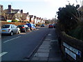
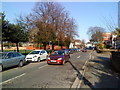
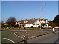
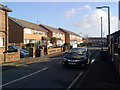
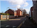
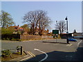
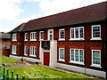
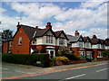
Photos of NG9 2HB
Area Information
Living in NG9 2HB means residing within a tightly packed residential cluster covering just 3,446 square metres. This postcode area serves a specific population of 2,006 people, creating a dense neighbourhood environment where daily interactions are frequent and local amenities are within immediate reach. The high population density of 582,062 people per square kilometre reflects a community where space is at a premium and infrastructure supports compact living rather than sprawling suburbs. Prospective homebuyers will find this area distinct for its concentration of residents in a very small geographical footprint, typical of urban hinterlands in Nottingham. Daily life here moves at a rapid pace, utilising the proximity to transport hubs and retail centres that line the surrounding streets. The area functions as a practical base for commuters accessing Nottingham city centre or the university district while maintaining a distinct local identity. You live in a setting defined by efficiency and proximity, where the boundary between your doorstep and the wider town is exceptionally thin. This compact nature ensures that you never have to travel far for essential services, though the lack of open space is inherent to the small area size. The neighbourhood operates as a microcosm of Beeston and the wider Nottingham region, offering a snapshot of modern urban living for those who prioritise location over land.
- Area Type
- Postcode
- Area Size
- 3446 m²
- Population
- 2006
- Population Density
- 8864 people/km²
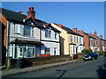
The property market in NG9 2HB is defined by a specific housing stock composed of houses, with 56% of properties occupied by their owners. This high ownership rate suggests that the area functions primarily as a market for buying rather than a pure rental hub. Buyers should note that the accommodation type consists of houses, meaning the physical layout differs significantly from tower blocks or conversion flats found in other Nottingham postcodes. Given the extremely small area size of 3,446 square metres, the housing quantity is limited, which often drives competitive pricing and fast sales for available stock. This postcode represents a niche segment of the local market where you compete for a specific number of properties within a confined residential cluster. The 56% ownership statistic indicates that a majority of households have built equity in their homes, making this area attractive to lenders and sellers alike. For those seeking freehold properties or detached homes in this urban setting, NG9 2HB offers a viable option within the broader Beeston and Nottingham property landscape. You will find that the market here reflects the needs of young adults who have managed to purchase whole houses despite the dense living environment. The combination of houses and high ownership creates a stable local estate where residents have a vested interest in maintaining property values.
House Prices in NG9 2HB
Showing 29 properties
| Address | Type | Beds | Baths | Last Sale Price | Last Sale Date | |
|---|---|---|---|---|---|---|
| 4, Cedar Court, Cedar Avenue, Beeston, NG9 2HB | Flat | - | - | - | - | |
| 24, Cedar Court, Cedar Avenue, Beeston, NG9 2HB | Flat | - | - | - | - | |
| 28, Cedar Court, Cedar Avenue, Beeston, NG9 2HB | Flat | - | - | - | - | |
| 25, Cedar Court, Cedar Avenue, Beeston, NG9 2HB | Flat | - | - | - | - | |
| 14, Cedar Court, Cedar Avenue, Beeston, NG9 2HB | Flat | - | - | - | - | |
| 18, Cedar Court, Cedar Avenue, Beeston, NG9 2HB | Flat | - | - | - | - | |
| 20, Cedar Court, Cedar Avenue, Beeston, NG9 2HB | Flat | - | - | - | - | |
| 12A, Cedar Court, Cedar Avenue, Beeston, NG9 2HB | Flat | - | - | - | - | |
| 17, Cedar Court, Cedar Avenue, Beeston, NG9 2HB | Flat | - | - | - | - | |
| 12, Cedar Court, Cedar Avenue, Beeston, NG9 2HB | Flat | - | - | - | - |
Energy Efficiency in NG9 2HB
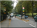
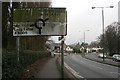
Residents of NG9 2HB enjoy immediate access to a wide range of amenities, shops, and transport hubs within practical reach. For grocery shopping, you can visit Sainsburys Beeston, Lidl Beeston, or Co-op Nottingham, all listed as notable nearby options. This variety ensures you have multiple choices for fresh food, budget shopping, and everyday essentials without needing to plan a long trip. Transport links are equally comprehensive, with five metro hubs including the Middle Street Bus and Tram Interchange and the University Boulevard Tram Stop right on your doorstep. You can easily access Nottingham Railway Station, Attenborough Railway Station, and Beeston Railway Station to reach wider destinations across the country. Nottingham Airport sits nearby, providing quick access to international travel for residents of this postcode. The proximity to five retail centres and multiple transport nodes creates a lifestyle where convenience dictates your daily routine. You can run errands in the morning and catch a train or tram in the evening, all while staying within the local cluster. The density of these facilities means you rarely need a car for short journeys, relying instead on walking or public transport to access services. This mix of five retail outlets and five major transport points supports a busy, active lifestyle centred on accessibility.
Amenities
Schools
Families considering NG9 2HB have access to Dagfa School Nottingham, which is the nearest educational establishment listed for this area. Dagfa School Nottingham operates as an independent school, providing a distinct educational option compared to the state-funded academies or primary schools common elsewhere in the region. The presence of an independent school nearby offers an alternative pathway for children who seek a specific curriculum or educational environment outside the standard state system. As there are no other schools listed in the immediate vicinity, parents must plan their routes carefully if they require state-sector education or multiple schooling options within walking distance. The single school entry highlights a unique situation where residents rely heavily on this one institution for local education, potentially creating long queues or waiting lists if they seek independent schooling without transport arrangements. You should verify if the distance to Dagfa School Nottingham fits your family's routine given the postcode's location relative to the school grounds. The mix of educational access is limited to this single named venue, meaning diversity in school choice depends largely on your willingness to commute to other parts of Nottingham. It is essential to research the specific intake policies of Dagfa School Nottingham before viewing homes in this specific cluster.
| Rank | School | Type | Entry gender | Ages |
|---|
Explore more schools in this area
Go to Schools tabDemographics
The community in NG9 2HB is predominantly young, with a median age of just 22 years. Young adults between the ages of 15 and 29 make up the most common age range within this population, defining the social energy of the neighbourhood. Fifty-six per cent of residents own their homes, indicating a strong level of stability and investment among the younger demographic in this postcode. The area features houses as the primary accommodation type, distinguishing it from regions dominated by flats or apartments. While the predominant ethnic group is White, the high percentage of home ownership among young adults suggests a successful transition from student living to settled tenancy or purchase. This age profile creates a vibrant, dynamic atmosphere where long-term residents mix with graduates and young professionals. The demographic data paints a picture of a neighbourhood that has successfully attracted young buyers who prefer owning a house rather than renting. With over half the population having secured their own property, the area likely maintains lower vacancy rates and more engaged neighbours. You are entering a community where the typical household consists of individuals or young families establishing their independent lives close to the city centre.
Household Size
Accommodation Type
Tenure
Ethnic Group
Religion
Household Composition
Age
Household Deprivation
NS-SEC
Explore more demographic insights in this area
Go to Demographics tabPlanning
Planning Constraints
- Flood RiskPremium
- Ramsar Wetland SitesPremium
- Area of Outstanding Natural BeautyPremium
- Protected Nature ReservePremium
- Protected WoodlandPremium