Area Overview for NG9 2GF
Photos of NG9 2GF
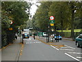
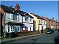
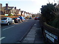
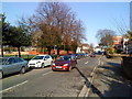
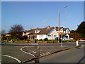
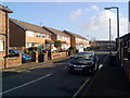
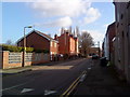
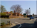
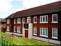
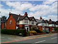
100 photos from this area
Area Information
Key information about the NG9 2GF including its size, population, and administrative classification.
- Area Type
- Postcode
- Area Size
- 1.3 hectares
- Population
- 4950
- Population Density
- 3972 people/km²
House Prices in NG9 2GF
42
Properties
£120,043
Average Sold Price
£33,000
Lowest Price
£243,000
Highest Price
Showing 42 properties
| Address | Type | Beds | Baths | Last Sale Price | Last Sale Date | |
|---|---|---|---|---|---|---|
| 108 Manton Crescent, Nottingham, NG9 2GF | Terraced | 2 | 1 | £170,000 | Dec 2024 | |
| 106 Manton Crescent, Nottingham, NG9 2GF | Semi-detached | 2 | 1 | £135,000 | Apr 2024 | |
| 102 Manton Crescent, Nottingham, NG9 2GF | Terraced | 3 | 3 | £243,000 | Oct 2023 | |
| 58 Manton Crescent, Nottingham, NG9 2GF | Semi-detached | 3 | 1 | £175,000 | Jul 2023 | |
| 98 Manton Crescent, Nottingham, NG9 2GF | Terraced | 2 | 1 | £200,000 | Mar 2023 | |
| 80 Manton Crescent, Nottingham, NG9 2GF | Retail | 2 | 1 | £193,500 | Sep 2022 | |
| 136 Manton Crescent, Nottingham, NG9 2GF | Terraced | 2 | 1 | £183,000 | Jun 2022 | |
| 110 Manton Crescent, Nottingham, NG9 2GF | house | - | - | £135,000 | Feb 2021 | |
| 100 Manton Crescent, Nottingham, NG9 2GF | house | - | - | £155,000 | Dec 2020 | |
| 82 Manton Crescent, Nottingham, NG9 2GF | Terraced | 3 | 1 | £144,000 | Sep 2019 |
Page 1 of 5
Energy Efficiency in NG9 2GF
Amenities
Schools
| Rank | School | Type | Entry gender | Ages |
|---|
Explore more schools in this area
Go to Schools tabDemographics
Household Size
Two person
most common
Accommodation Type
Houses
most common
Tenure
32
majority
Ethnic Group
White
most common
Religion
N/A
most common
Household Composition
N/A
most common
Age
22
median
Young Adults (15-29 years)
most common
Household Deprivation
N/A
with no deprivation
NS-SEC
10
in Lower managerial occupations
Explore more demographic insights in this area
Go to Demographics tabPlanning
Planning Constraints
- Flood RiskPremium
- Ramsar Wetland SitesPremium
- Area of Outstanding Natural BeautyPremium
- Protected Nature ReservePremium
- Protected WoodlandPremium