Area Overview for NG9 2GA
Photos of NG9 2GA
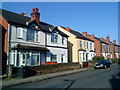
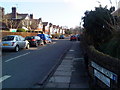
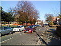
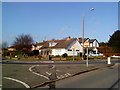
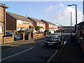
100 photos from this area
Area Information
Key information about the NG9 2GA including its size, population, and administrative classification.
- Area Type
- Postcode
- Area Size
- 5295 m²
- Population
- 4950
- Population Density
- 3972 people/km²
House Prices in NG9 2GA
18
Properties
£100,682
Average Sold Price
£41,000
Lowest Price
£170,000
Highest Price
Showing 18 properties
| Address | Type | Beds | Baths | Last Sale Price | Last Sale Date | |
|---|---|---|---|---|---|---|
| 144 Manton Crescent, Nottingham, NG9 2GA | house | 3 | - | £170,000 | Oct 2021 | |
| 170 Manton Crescent, Nottingham, NG9 2GA | Semi-detached | 2 | 1 | £117,500 | Jan 2019 | |
| 164 Manton Crescent, Nottingham, NG9 2GA | Terraced | 2 | 1 | £135,000 | May 2018 | |
| 154 Manton Crescent, Nottingham, NG9 2GA | Terraced | 2 | 1 | £99,000 | Mar 2017 | |
| 172 Manton Crescent, Nottingham, NG9 2GA | Terraced | 3 | - | £95,000 | Oct 2015 | |
| 156 Manton Crescent, Nottingham, NG9 2GA | house | - | - | £95,000 | Oct 2010 | |
| 166 Manton Crescent, Nottingham, NG9 2GA | Terraced | 3 | 1 | £91,000 | Feb 2010 | |
| 174 Manton Crescent, Nottingham, NG9 2GA | Terraced | - | - | £93,000 | Jun 2007 | |
| 158 Manton Crescent, Nottingham, NG9 2GA | Terraced | 2 | 1 | £102,000 | Jan 2005 | |
| 150 Manton Crescent, Nottingham, NG9 2GA | Terraced | 3 | 1 | £69,000 | Nov 2002 |
Page 1 of 2
Energy Efficiency in NG9 2GA
Amenities
Schools
| Rank | School | Type | Entry gender | Ages |
|---|
Explore more schools in this area
Go to Schools tabDemographics
Household Size
Two person
most common
Accommodation Type
Houses
most common
Tenure
32
majority
Ethnic Group
White
most common
Religion
N/A
most common
Household Composition
N/A
most common
Age
22
median
Young Adults (15-29 years)
most common
Household Deprivation
N/A
with no deprivation
NS-SEC
10
in Lower managerial occupations
Explore more demographic insights in this area
Go to Demographics tabPlanning
Planning Constraints
- Flood RiskPremium
- Ramsar Wetland SitesPremium
- Area of Outstanding Natural BeautyPremium
- Protected Nature ReservePremium
- Protected WoodlandPremium