Area Overview for NG9 2ES
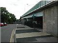
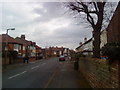
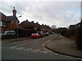
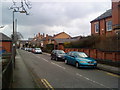
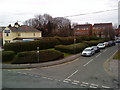
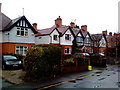
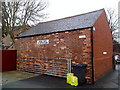
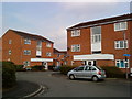
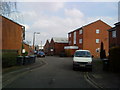
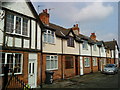
Photos of NG9 2ES


Area Information
NG9 2ES is a compact residential cluster covering just 1.6 hectares, serving a population of 1,652 people. This small postcode area contains nearly 165 families within a densely settled landscape, resulting in a population density of 100,489 people per square kilometre. Daily life here is defined by proximity to urban centres located just beyond the local boundary. Residents benefit from immediate access to five tram stops, including Middle Street and the Tram and Bus Interchange, which provide direct links to the wider city network. The character of this neighbourhood relies heavily on its connectivity rather than extensive green space. While the area lacks protected nature reserves or designated Areas of Outstanding Natural Beauty, its location ensures practical reach to essential services. Five railway stations, from Beeston to Nottingham, sit within practical reach for daily commuting. Five major retail outlets, including Tesco Nottingham and Sainsburys Beeston, offer convenience for weekly shopping. One airport, Nottingham Airport, is also accessible for travel needs. Living in NG9 2ES means accepting a high-density environment in exchange for excellent transport links and immediate access to the amenities of Nottingham.
- Area Type
- Postcode
- Area Size
- 1.6 hectares
- Population
- 1652
- Population Density
- 7075 people/km²
The housing stock in NG9 2ES is characterised by houses, which align with the requirements of the local demographic. With 42 per cent of households owning their homes, there is a significant owner-occupied element to the market. This figure suggests that the area has attracted buyers seeking stability over the years, rather than developers targeting a purely temporary rental sector. Given the small size of the postcode area, covering only 1.6 hectares, the number of available properties will be limited. Buyers looking at this specific area should expect a tight competition for available homes. The high population density of 100,489 people per square kilometre reinforces the scarcity of land for new development. Consequently, existing houses represent valuable assets for those wishing to settle in this location. The mix of owner-occupiers points to a community focused on long-term residence. Prospective buyers should act quickly if they wish to secure a home in this compact cluster, as the practical demand from families and professionals outweighs the restricted supply of dwellings.
House Prices in NG9 2ES
Showing 44 properties
| Address | Type | Beds | Baths | Last Sale Price | Last Sale Date | |
|---|---|---|---|---|---|---|
| 45 Queens Drive, Beeston, NG9 2ES | house | - | - | £130,000 | Sep 2025 | |
| 19 Queens Drive, Beeston, NG9 2ES | Semi-detached | 3 | - | £375,000 | Mar 2025 | |
| 7 Queens Drive, Beeston, NG9 2ES | Semi-detached | 3 | 2 | £320,000 | Mar 2025 | |
| 43 Queens Drive, Beeston, NG9 2ES | Semi-detached | 3 | 1 | £330,000 | Jun 2024 | |
| 10 Queens Drive, Beeston, NG9 2ES | Semi-detached | 3 | 1 | £320,000 | Jan 2024 | |
| 17 Queens Drive, Beeston, NG9 2ES | house | - | - | £305,000 | Dec 2021 | |
| 28 Queens Drive, Beeston, NG9 2ES | house | - | - | £275,000 | Jun 2021 | |
| 27 Queens Drive, Beeston, NG9 2ES | Semi-detached | 3 | 1 | £265,000 | Mar 2020 | |
| 37 Queens Drive, Beeston, NG9 2ES | Semi-detached | 3 | 1 | £267,000 | Jan 2020 | |
| 32 Queens Drive, Beeston, NG9 2ES | Semi-detached | 3 | 1 | £242,000 | Apr 2019 |
Energy Efficiency in NG9 2ES
Residents of NG9 2ES enjoy immediate access to a range of commercial and leisure facilities. Five retail locations are within practical reach, providing ample choice for daily shopping. Tesco Nottingham, Sainsburys Beeston, and the Co-op Queens are notable supermarkets where locals purchase groceries and household essentials. Five metro amenities, such as the Middle Street Tram Stop, facilitate quick journeys to the wider city centre. Five railway stations offer further options for rail commuters. One airport, Nottingham Airport, is accessible for travel needs. These five transport hubs and five retail outlets create a convenient environment where residents do not need to travel far for basic requirements. The proximity of these amenities supports a lifestyle that balances suburban living with urban convenience. While the area itself is small at 1.6 hectares, the reach of five major supermarkets and five train stations expands the effective living space. Dining and leisure options are anchored by these retail and transport nodes. Living in NG9 2ES means that essential services are never far away, reducing the need for long commutes to neighbouring towns for daily needs.
Amenities
Schools
Families living in NG9 2ES have primary education needs met by John Clifford Primary School. This institution serves the immediate residential cluster and provides early-years education to local children. The school holds a 'good' Ofsted rating, indicating a standard of quality that meets regulatory expectations for primary education provision. While the data lists John Clifford Primary School twice, it represents a single facility serving the local area. This means that younger children in NG9 2ES attend the same comprehensive primary institution. The concentration of children within the 30 to 64 age group suggests strong birth rates among local residents. Homebuyers with school-aged children should note that this is the primary educational option within the immediate vicinity. Junior or secondary schools are not listed in the provided data for this specific cluster, so families may need to look further afield for older children. The presence of a rated-good primary school adds practical value for households with young dependents moving into the postcode.
| Rank | School | Type | Entry gender | Ages |
|---|
Explore more schools in this area
Go to Schools tabDemographics
The community in NG9 2ES reflects a mature demographic profile with a median age of 47 years. Adults between the ages of 30 and 64 constitute the most common age range, suggesting a population comprised largely of established households rather than young professionals or retirees. This age distribution indicates a stable community where long-term residents form the backbone of the local economy and social fabric. Home ownership stands at 42 per cent, meaning slightly less than half of the households own their properties outright. The remaining homes are generally rented or owned with mortgages. Houses are the predominant accommodation type, fitting the demographic profile of older families or established couples. The population is predominantly White, mirroring the broader settlement patterns of the region. With nearly 1,650 residents packed into such a small footprint, the social environment is intimate yet subject to the pressures of urban density. This concentration of adults supports local community initiatives and maintains a steady presence in nearby schools and workplaces.
Household Size
Accommodation Type
Tenure
Ethnic Group
Religion
Household Composition
Age
Household Deprivation
NS-SEC
Explore more demographic insights in this area
Go to Demographics tabPlanning
Planning Constraints
- Flood RiskPremium
- Ramsar Wetland SitesPremium
- Area of Outstanding Natural BeautyPremium
- Protected Nature ReservePremium
- Protected WoodlandPremium