Area Overview for NG9 2DB
Photos of NG9 2DB
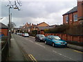
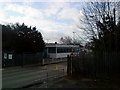
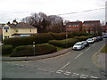
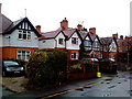
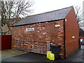
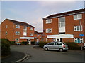
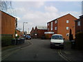
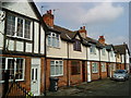
100 photos from this area
Area Information
Key information about the NG9 2DB including its size, population, and administrative classification.
- Area Type
- Postcode
- Area Size
- 3649 m²
- Population
- 1652
- Population Density
- 7075 people/km²
House Prices in NG9 2DB
20
Properties
£151,600
Average Sold Price
£115,000
Lowest Price
£190,000
Highest Price
Showing 20 properties
| Address | Type | Beds | Baths | Last Sale Price | Last Sale Date | |
|---|---|---|---|---|---|---|
| 192 Queens Road, Beeston, NG9 2DB | Terraced | 3 | 1 | £190,000 | Dec 2022 | |
| 196 Queens Road, Beeston, NG9 2DB | Terraced | 4 | 1 | £170,000 | Oct 2022 | |
| 186 Queens Road, Beeston, NG9 2DB | Flat | 5 | 4 | £160,000 | Feb 2017 | |
| 194 Queens Road, Beeston, NG9 2DB | Terraced | 4 | 1 | £123,000 | Aug 2016 | |
| 200 Queens Road, Beeston, NG9 2DB | Flat | - | 1 | £115,000 | Dec 2003 | |
| 188A Queens Road, Beeston, NG9 2DB | Terraced | 4 | 1 | - | - | |
| 188B Queens Road, Beeston, NG9 2DB | Terraced | 3 | 1 | - | - | |
| Flat Above, 208-210 Queens Road, Beeston, NG9 2DB | Flat | 3 | 1 | - | - | |
| 188 Queens Road, Beeston, NG9 2DB | Flat | 1 | 1 | - | - | |
| Room 1, 186 Queens Road, Beeston, NG9 2DB | Unknown | - | - | - | - |
Page 1 of 2
Energy Efficiency in NG9 2DB
Amenities
Schools
| Rank | School | Type | Entry gender | Ages |
|---|
Explore more schools in this area
Go to Schools tabDemographics
Household Size
Two person
most common
Accommodation Type
Houses
most common
Tenure
42
majority
Ethnic Group
White
most common
Religion
N/A
most common
Household Composition
N/A
most common
Age
47
median
Adults (30-64 years)
most common
Household Deprivation
N/A
with no deprivation
NS-SEC
27
in Lower managerial occupations
Explore more demographic insights in this area
Go to Demographics tabPlanning
Planning Constraints
- Flood RiskPremium
- Ramsar Wetland SitesPremium
- Area of Outstanding Natural BeautyPremium
- Protected Nature ReservePremium
- Protected WoodlandPremium