Area Overview for NG9 1LF
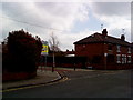
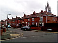
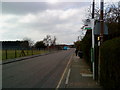
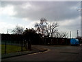
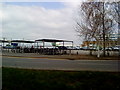
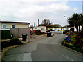
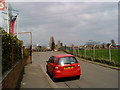
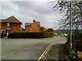
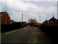
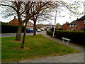
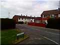
Photos of NG9 1LF

Area Information
Living in NG9 1LF means residing within a specific residential cluster defined by postcode NG9 1LF. This area covers 1,692 square metres and houses a population of 1,789 people. You are entering a community with a very compact footprint, resulting in a density that reflects a focused residential environment. The location sits in the heart of England, offering a direct connection to the wider Nottingham region. Daily life here is grounded in the practicalities of a settled neighbourhood where residents know their local surroundings intimately. The area functions as a distinct pocket of housing rather than a sprawling suburb. You will find that the immediate vicinity is designed for those who value proximity and stability over urban expansion. The demographic profile suggests a mature community where long-term residents form the backbone of the local social fabric. When you consider homes in NG9 1LF, you are looking at a space that has been developed to support a stable population. The small size of the postcode area means that services and neighbours are often within immediate walking or driving distance. This specific layout creates a tight-knit environment where the boundaries of your daily commute and social life are clearly defined by the physical limits of the postal code.
- Area Type
- Postcode
- Area Size
- 1692 m²
- Population
- 1789
- Population Density
- 4109 people/km²
The property market in NG9 1LF is characterised by a strong owner-occupier base. With 62% of homes owned outright or with a mortgage, rental demand remains secondary to owner retention. This high ownership rate often reduces turnover compared to areas with a dominant private rental sector. Houses make up the vast majority of accommodation, meaning you will find rows of family-sized properties rather than blocks of flats or studio apartments. This housing stock is tailored for families and individuals who wish to settle long term in a specific location. The small footprint of NG9 1LF, covering just 1,692 square metres, limits the total number of listings available at any given time. Consequently, properties move less frequently, and those currently for sale may stay on the market for extended periods. Families looking for houses in this specific postcode cluster will find a market driven by homeowners upgrading or downsizing locally. The lack of significant rental pressure suggests that tenants have fewer options in this micro-geography. Buyers should focus on whether they wish to join this stable, ownership-heavy community or if they prefer a location with more transient properties. The accommodation mix reflects a traditional suburban model where single-family homes dominate the streetscape.
House Prices in NG9 1LF
Showing 13 properties
| Address | Type | Beds | Baths | Last Sale Price | Last Sale Date | |
|---|---|---|---|---|---|---|
| 9 Nelson Road, Beeston, NG9 1LF | house | 2 | 1 | £248,000 | Nov 2022 | |
| 21 Nelson Road, Beeston, NG9 1LF | Terraced | 2 | 1 | £170,000 | Aug 2021 | |
| 19 Nelson Road, Beeston, NG9 1LF | Terraced | 2 | 1 | £140,000 | Aug 2020 | |
| 17 Nelson Road, Beeston, NG9 1LF | Terraced | 2 | 1 | £128,500 | Nov 2018 | |
| 11 Nelson Road, Beeston, NG9 1LF | Terraced | 2 | 1 | £122,000 | Oct 2016 | |
| 23 Nelson Road, Beeston, NG9 1LF | Terraced | 2 | - | £67,000 | May 2012 | |
| 25 Nelson Road, Beeston, NG9 1LF | Terraced | 2 | 1 | £75,000 | Mar 2011 | |
| 13 Nelson Road, Beeston, NG9 1LF | house | 2 | 1 | £84,500 | Nov 2006 | |
| 15 Nelson Road, Beeston, NG9 1LF | house | - | - | £60,000 | Jun 2002 | |
| 5 Nelson Road, Beeston, NG9 1LF | Terraced | 3 | - | £64,000 | Jun 2002 |
Energy Efficiency in NG9 1LF
Residents of NG9 1LF benefit from a wide range of amenities within practical reach, including shopping, transport, and leisure facilities. You have access to five major rail hubs, with Beeston Railway Station, Attenborough Railway Station, and Nottingham Railway Station serving as key transport nodes. The area also hosts five notable retail locations. Co-op Queens, Tesco Nottingham, and Co-op Beeston provide convenient shopping options for groceries and daily essentials. Public transport links are extensive, with five metro points available. The Tram and Bus Interchange, Beeston Centre Tram Stop, and Bus and Tram Interchange ensure seamless travel across the city. One airport, Nottingham Airport, is located nearby for those requiring air travel. These amenities are located so close that they form part of your daily routine. You can shop at Co-op Beeston or catch a bus at the Beeston Centre without needing a car. The presence of these services means your lifestyle is centred on convenience and accessibility. Commuting to Nottingham or travelling abroad becomes simple with these connections. The variety of options ensures that work, shopping, and leisure are easily integrated into your day. Living in NG9 1LF means you never have to travel far to access essential services.
Amenities
Schools
Families residing in NG9 1LF have access to two specific schools within immediate proximity. Beeston Rylands Junior School serves the primary education needs of younger children and holds a good Ofsted rating. This institution provides a solid foundation for early learning in a recognised educational setting. Trent Vale Infant School is the second key provider, also holding a good Ofsted rating. This primary school complements the local educational landscape by offering schooling for the youngest pupils. The presence of these two schools ensures that young children can access education without travelling far from their homes in NG9 1LF. A mix of infant and junior primary schools allows for a seamless transition between different stages of compulsory education. Both institutions have secured a good rating, which indicates consistent performance and adherence to national educational standards. You do not need to look beyond this neighbourhood for these essential services. The proximity of these schools suggests that the area caters specifically to families with young children. When planning your move, you can confirm that schooling is integrated directly into the locality. The combination of Beeston Rylands Junior School and Trent Vale Infant School provides a complete primary education pathway right on your doorstep.
| Rank | School | Type | Entry gender | Ages |
|---|
Explore more schools in this area
Go to Schools tabDemographics
The community in NG9 1LF is defined by a stable and mature age profile. The median age for residents is 47 years, placing the population firmly within the older half of the adult demographic. Adults aged between 30 and 64 years represent the most common age range, dominating the local landscape. This indicates a neighbourhood populated primarily by working-age families and established professionals rather than young singles or retirees. Home ownership stands at an impressive 62%, a figure that signals significant stability within the stock. You can assume that two thirds of households are owner-occupied, with the remaining third comprising private or social renters. Houses are the predominant attraction type for accommodation here, meaning the streets are lined with traditional detached or semi-detached properties rather than flats. White residents form the predominant ethnic group, suggesting a homogenous community with established local traditions. With over one thousand houses, you can expect a typical suburban feel. The high rate of ownership suggests that many families have lived in these homes for decades, creating a settled atmosphere. This demographic structure implies that the area appeals to those seeking quiet streets and a sense of permanence.
Household Size
Accommodation Type
Tenure
Ethnic Group
Religion
Household Composition
Age
Household Deprivation
NS-SEC
Explore more demographic insights in this area
Go to Demographics tabPlanning
Planning Constraints
- Flood RiskPremium
- Ramsar Wetland SitesPremium
- Area of Outstanding Natural BeautyPremium
- Protected Nature ReservePremium
- Protected WoodlandPremium