Area Overview for NG9 1HU
Photos of NG9 1HU
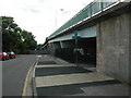
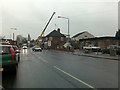
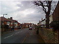
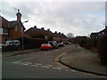
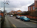
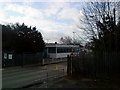
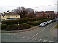
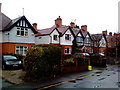
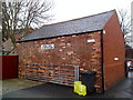
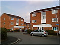
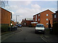
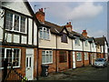
100 photos from this area
Area Information
Key information about the NG9 1HU including its size, population, and administrative classification.
- Area Type
- Postcode
- Area Size
- 1.3 hectares
- Population
- 1552
- Population Density
- 4954 people/km²
House Prices in NG9 1HU
14
Properties
£241,578
Average Sold Price
£58,500
Lowest Price
£450,750
Highest Price
Showing 14 properties
| Address | Type | Beds | Baths | Last Sale Price | Last Sale Date | |
|---|---|---|---|---|---|---|
| 57 Dovecote Lane, Beeston, NG9 1HU | Terraced | 5 | 1 | £450,750 | May 2025 | |
| 20 Dovecote Lane, Beeston, NG9 1HU | Semi-detached | 3 | 2 | £315,000 | Jan 2024 | |
| 63 Dovecote Lane, Beeston, NG9 1HU | Semi-detached | 5 | 3 | £410,000 | Aug 2018 | |
| 18 Dovecote Lane, Beeston, NG9 1HU | Semi-detached | 3 | 1 | £168,000 | Aug 2015 | |
| 61 Dovecote Lane, Beeston, NG9 1HU | Terraced | 5 | - | £309,000 | Jun 2014 | |
| 59 Dovecote Lane, Beeston, NG9 1HU | Terraced | 4 | - | £239,950 | Apr 2007 | |
| 65 Dovecote Lane, Beeston, NG9 1HU | Detached | - | - | £135,000 | Nov 2001 | |
| 26 Dovecote Lane, Beeston, NG9 1HU | Semi-detached | - | - | £88,000 | Apr 2001 | |
| 24 Dovecote Lane, Beeston, NG9 1HU | Flat | 1 | 1 | £58,500 | Jan 1995 | |
| Flat 1, 65 Dovecote Lane, Beeston, NG9 1HU | Flat | - | - | - | - |
Page 1 of 2
Energy Efficiency in NG9 1HU
Amenities
Schools
| Rank | School | Type | Entry gender | Ages |
|---|
Explore more schools in this area
Go to Schools tabDemographics
Household Size
Two person
most common
Accommodation Type
Houses
most common
Tenure
64
majority
Ethnic Group
White
most common
Religion
N/A
most common
Household Composition
N/A
most common
Age
47
median
Adults (30-64 years)
most common
Household Deprivation
N/A
with no deprivation
NS-SEC
47
in Lower managerial occupations
Explore more demographic insights in this area
Go to Demographics tabPlanning
Planning Constraints
- Flood RiskPremium
- Ramsar Wetland SitesPremium
- Area of Outstanding Natural BeautyPremium
- Protected Nature ReservePremium
- Protected WoodlandPremium