Area Overview for NG9 1HR
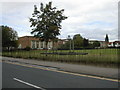
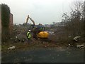
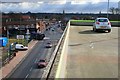
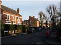
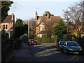
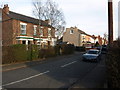
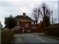
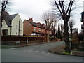
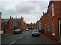
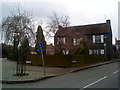
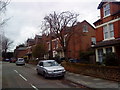
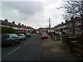
Photos of NG9 1HR
Area Information
Living in NG9 1HR means residing within a compact residential cluster of 1.4 hectares that houses 1641 people. This postcode area represents a tightly knit neighbourhood where density reaches 120,759 people per square kilometre, creating an environment defined by proximity to essential services. The location sits within the NG9 postcode region near Beeston, serving as a functional part of the wider Nottingham urban landscape. Daily life here is characterised by immediate access to major transport hubs and retail centres without the isolation of rural settings. You will find yourself in a setting where every household is close to action, yet the area maintains its identity as a distinct residential zone. The area does not cover large parks or reserves; instead, its planning constraints allow for standard urban development. There are no Ramsar wetland sites or Areas of Outstanding Natural Beauty limiting construction, which means the local infrastructure adapts efficiently to community needs. Residents benefit from a location that balances urban convenience with sufficient living space, although the small footprint limits the scope for large private gardens. For those seeking homes in this postcode, the layout ensures quick walks to the tram stops and bus interchanges that dominate the local transport network.
- Area Type
- Postcode
- Area Size
- 1.4 hectares
- Population
- 1641
- Population Density
- 5861 people/km²
Homes in NG9 1HR are primarily houses, a fact confirmed by the accommodation type data for this postcode. With 40% of residents being home owners and the remainder likely renting, the area offers a mix of properties suitable for different financial situations. This area represents a significant portion of the NG9 postcode region, acting as a bridge between more central districts and outer suburbs. The small size of 1.4 hectares means the housing stock is concentrated, meaning less variety in terms of large estates or sprawling developments. Buyers looking into this sector should note that the 40% owner occupation rate is typical for suburban clusters in Nottinghamshire. The high density of 120,759 people per square kilometre suggests properties may be closer together than in rural areas. Because the area consists mainly of houses, you can expect a suburban feel rather than a high-rise urban environment. This makes NG9 1HR attractive to those who want single-family dwellings but remain close to the city centre. The concentration of homes also means new construction opportunities may be limited by the existing urban fabric.
House Prices in NG9 1HR
Showing 29 properties
| Address | Type | Beds | Baths | Last Sale Price | Last Sale Date | |
|---|---|---|---|---|---|---|
| 37 Dovecote Lane, Beeston, NG9 1HR | Terraced | 4 | 1 | £508,250 | Mar 2025 | |
| 15 Dovecote Lane, Beeston, NG9 1HR | Bungalow | 3 | 1 | £475,000 | Oct 2024 | |
| 19 Dovecote Lane, Beeston, NG9 1HR | Detached | 4 | 2 | £530,000 | Apr 2020 | |
| Aspire Health And Care Limited, 35 Dovecote Lane, Beeston, NG9 1HR | hospital_care_home | - | - | £800,000 | Jan 2018 | |
| 21 Dovecote Lane, Beeston, NG9 1HR | Bungalow | 2 | 2 | £237,000 | Jun 2016 | |
| 4 Dovecote Lane, Beeston, NG9 1HR | house | - | - | £250,000 | Nov 2015 | |
| 41 Dovecote Lane, Beeston, NG9 1HR | Terraced | 3 | 2 | £230,000 | Mar 2015 | |
| 47 Dovecote Lane, Beeston, NG9 1HR | Semi-detached | 4 | 3 | £287,500 | Aug 2013 | |
| 53 Dovecote Lane, Beeston, NG9 1HR | Semi-detached | 4 | - | £275,000 | Jul 2013 | |
| 49 Dovecote Lane, Beeston, NG9 1HR | Semi-detached | - | - | £200,000 | Sep 2010 |
Energy Efficiency in NG9 1HR
Shopping and leisure facilities in NG9 1HR are extensive due to the proximity of the Beeston Centre. Inside, you will find Co-op Queens and Tesco Nottingham, alongside other retailers located near the tram stop. The Co-op Beeston provides familiar supermarket services for daily grocery needs. Residents enjoy immediate access to these retail environments without needing a car for staple items. Beyond shopping, the area offers strong transport-based leisure options. The tram and bus interchange serves as a social node where many locals gather before or after work. Nottingham Airport provides a connection for longer trips, linking you to international destinations. The concentration of amenities within this 1.4 hectare area means you can run most errands locally. While there are no specific parks or nature reserves listed in the immediate data, the planning constraints show a lack of restrictions, which often translates to accessible public parks nearby in the wider Beeston district. The presence of multiple railway stations nearby also serves leisure travel to destinations like Lincoln and Leicester, making weekend getaways convenient.
Amenities
Schools
| Rank | School | Type | Entry gender | Ages |
|---|
Explore more schools in this area
Go to Schools tabDemographics
The community in NG9 1HR skews towards established residents, with a median age of 47 years. The most common age range for people living here falls between 30 and 64 years, indicating a population of adults likely with families or grown children returning home. This age profile suggests a neighbourhood that has attracted those seeking stability rather than those just entering the housing market. Regarding ethnicity, the predominant group is White, reflecting the broader demographic trends of the region. Home ownership stands at 40%, meaning nearly half of the households in this small cluster rent their accommodation. This split indicates a mixed community where ownership and private renting coexist. The predominant accommodation type is houses, which aligns with the demographic preference for larger living spaces suitable for families. Deprivation levels are not highlighted in the specific data provided for this small area, but the age distribution suggests a stable, middle-aged population.
Household Size
Accommodation Type
Tenure
Ethnic Group
Religion
Household Composition
Age
Household Deprivation
NS-SEC
Explore more demographic insights in this area
Go to Demographics tabPlanning
Planning Constraints
- Flood RiskPremium
- Ramsar Wetland SitesPremium
- Area of Outstanding Natural BeautyPremium
- Protected Nature ReservePremium
- Protected WoodlandPremium