Area Overview for NG8 2SB
Photos of NG8 2SB
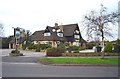
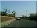
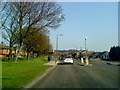
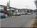
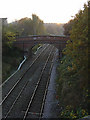
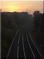
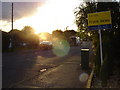
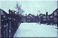
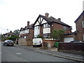
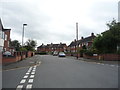
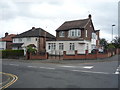
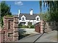
39 photos from this area
Area Information
Key information about the NG8 2SB including its size, population, and administrative classification.
- Area Type
- Postcode
- Area Size
- 2.2 hectares
- Population
- 1459
- Population Density
- 4087 people/km²
House Prices in NG8 2SB
44
Properties
£220,779
Average Sold Price
£73,500
Lowest Price
£410,000
Highest Price
Showing 44 properties
| Address | Type | Beds | Baths | Last Sale Price | Last Sale Date | |
|---|---|---|---|---|---|---|
| 84 Charlecote Drive, Nottingham, NG8 2SB | house | - | - | £372,500 | Aug 2021 | |
| 68 Charlecote Drive, Nottingham, NG8 2SB | house | - | - | £410,000 | Jun 2021 | |
| 58 Charlecote Drive, Nottingham, NG8 2SB | Detached | 4 | 2 | £396,250 | Nov 2020 | |
| 86 Charlecote Drive, Nottingham, NG8 2SB | Detached | 3 | 1 | £289,000 | Nov 2017 | |
| 54 Charlecote Drive, Nottingham, NG8 2SB | Detached | 3 | - | £300,000 | Jun 2017 | |
| 60 Charlecote Drive, Nottingham, NG8 2SB | Bungalow | 3 | - | £305,000 | Feb 2015 | |
| 46 Charlecote Drive, Nottingham, NG8 2SB | Bungalow | 2 | 1 | £203,000 | Jun 2013 | |
| 48 Charlecote Drive, Nottingham, NG8 2SB | house | - | - | £240,000 | May 2013 | |
| 82 Charlecote Drive, Nottingham, NG8 2SB | house | - | - | £306,000 | Dec 2012 | |
| 88 Charlecote Drive, Nottingham, NG8 2SB | Bungalow | - | - | £175,000 | Sep 2009 |
Page 1 of 5
Energy Efficiency in NG8 2SB
Amenities
Schools
| Rank | School | Type | Entry gender | Ages |
|---|
Explore more schools in this area
Go to Schools tabDemographics
Household Size
Two person
most common
Accommodation Type
Houses
most common
Tenure
91
majority
Ethnic Group
White
most common
Religion
N/A
most common
Household Composition
N/A
most common
Age
47
median
Adults (30-64 years)
most common
Household Deprivation
N/A
with no deprivation
NS-SEC
50
in Lower managerial occupations
Explore more demographic insights in this area
Go to Demographics tabPlanning
Planning Constraints
- Flood RiskPremium
- Ramsar Wetland SitesPremium
- Area of Outstanding Natural BeautyPremium
- Protected Nature ReservePremium
- Protected WoodlandPremium