Area Overview for NG8 2GS
Photos of NG8 2GS
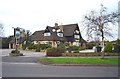
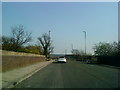
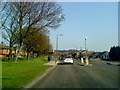
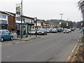

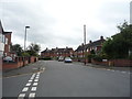
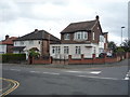
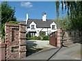
39 photos from this area
Area Information
Key information about the NG8 2GS including its size, population, and administrative classification.
- Area Type
- Postcode
- Area Size
- 3829 m²
- Population
- 1459
- Population Density
- 4087 people/km²
House Prices in NG8 2GS
12
Properties
£125,950
Average Sold Price
£54,995
Lowest Price
£150,000
Highest Price
Showing 12 properties
| Address | Type | Beds | Baths | Last Sale Price | Last Sale Date | |
|---|---|---|---|---|---|---|
| 4, Lingfield Court, Wollaton Vale, Nottingham, NG8 2GS | Flat | 1 | 1 | £150,000 | Apr 2025 | |
| 6, Lingfield Court, Wollaton Vale, Nottingham, NG8 2GS | Flat | 2 | 1 | £145,000 | Dec 2024 | |
| 5, Lingfield Court, Wollaton Vale, Nottingham, NG8 2GS | Flat | 2 | 1 | £150,000 | Apr 2024 | |
| 2, Lingfield Court, Wollaton Vale, Nottingham, NG8 2GS | Flat | - | - | £131,500 | Apr 2021 | |
| 11, Lingfield Court, Wollaton Vale, Nottingham, NG8 2GS | Flat | - | - | £150,000 | Nov 2020 | |
| 1, Lingfield Court, Wollaton Vale, Nottingham, NG8 2GS | Flat | - | - | £139,950 | Sep 2017 | |
| 10, Lingfield Court, Wollaton Vale, Nottingham, NG8 2GS | Flat | - | - | £116,500 | Feb 2017 | |
| 7, Lingfield Court, Wollaton Vale, Nottingham, NG8 2GS | Flat | - | - | £122,500 | May 2016 | |
| 8, Lingfield Court, Wollaton Vale, Nottingham, NG8 2GS | Flat | 2 | 1 | £119,000 | Jun 2013 | |
| 3, Lingfield Court, Wollaton Vale, Nottingham, NG8 2GS | Flat | - | - | £112,000 | Apr 2007 |
Page 1 of 2
Energy Efficiency in NG8 2GS
Amenities
Schools
| Rank | School | Type | Entry gender | Ages |
|---|
Explore more schools in this area
Go to Schools tabDemographics
Household Size
Two person
most common
Accommodation Type
Houses
most common
Tenure
91
majority
Ethnic Group
White
most common
Religion
N/A
most common
Household Composition
N/A
most common
Age
47
median
Adults (30-64 years)
most common
Household Deprivation
N/A
with no deprivation
NS-SEC
50
in Lower managerial occupations
Explore more demographic insights in this area
Go to Demographics tabPlanning
Planning Constraints
- Flood RiskPremium
- Ramsar Wetland SitesPremium
- Area of Outstanding Natural BeautyPremium
- Protected Nature ReservePremium
- Protected WoodlandPremium