Area Overview for NG5 6AU
Photos of NG5 6AU


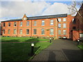
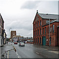
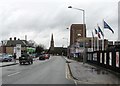
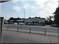
82 photos from this area
Area Information
Key information about the NG5 6AU including its size, population, and administrative classification.
- Area Type
- Postcode
- Area Size
- 7711 m²
- Population
- 1925
- Population Density
- 4831 people/km²
House Prices in NG5 6AU
25
Properties
£141,861
Average Sold Price
£60,000
Lowest Price
£237,500
Highest Price
Showing 25 properties
| Address | Type | Beds | Baths | Last Sale Price | Last Sale Date | |
|---|---|---|---|---|---|---|
| 22 Abbots Close, Daybrook, NG5 6AU | Semi-detached | 3 | 1 | £192,000 | Dec 2024 | |
| 7 Abbots Close, Daybrook, NG5 6AU | Semi-detached | 3 | 1 | £218,600 | Nov 2024 | |
| 9 Abbots Close, Daybrook, NG5 6AU | Semi-detached | 3 | 1 | £237,500 | Jan 2024 | |
| 16 Abbots Close, Daybrook, NG5 6AU | house | - | - | £164,000 | Sep 2020 | |
| 13 Abbots Close, Daybrook, NG5 6AU | Semi-detached | 3 | 1 | £133,000 | Mar 2018 | |
| 4 Abbots Close, Daybrook, NG5 6AU | Semi-detached | 3 | 1 | £123,000 | May 2017 | |
| 21 Abbots Close, Daybrook, NG5 6AU | Semi-detached | 3 | 1 | £122,000 | Apr 2017 | |
| 6 Abbots Close, Daybrook, NG5 6AU | Semi-detached | 3 | 1 | £125,000 | Mar 2016 | |
| 5 Abbots Close, Daybrook, NG5 6AU | Semi-detached | 3 | 1 | £124,950 | Dec 2015 | |
| 14A Abbots Close, Daybrook, NG5 6AU | Maisonette | 1 | 1 | £182,500 | Feb 2015 |
Page 1 of 3
Energy Efficiency in NG5 6AU
Amenities
Schools
| Rank | School | Type | Entry gender | Ages |
|---|
Explore more schools in this area
Go to Schools tabDemographics
Household Size
One person
most common
Accommodation Type
Houses
most common
Tenure
56
majority
Ethnic Group
White
most common
Religion
N/A
most common
Household Composition
N/A
most common
Age
47
median
Adults (30-64 years)
most common
Household Deprivation
N/A
with no deprivation
NS-SEC
26
in Lower managerial occupations
Explore more demographic insights in this area
Go to Demographics tabPlanning
Planning Constraints
- Flood RiskPremium
- Ramsar Wetland SitesPremium
- Area of Outstanding Natural BeautyPremium
- Protected Nature ReservePremium
- Protected WoodlandPremium