Area Overview for NG5 5DD
Photos of NG5 5DD
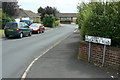
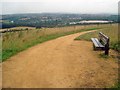
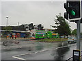
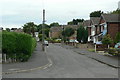
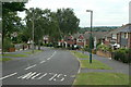
48 photos from this area
Area Information
Key information about the NG5 5DD including its size, population, and administrative classification.
- Area Type
- Postcode
- Area Size
- 7938 m²
- Population
- 1646
- Population Density
- 5467 people/km²
House Prices in NG5 5DD
20
Properties
£166,994
Average Sold Price
£70,000
Lowest Price
£300,000
Highest Price
Showing 20 properties
| Address | Type | Beds | Baths | Last Sale Price | Last Sale Date | |
|---|---|---|---|---|---|---|
| 239 Brownlow Drive, Nottingham, NG5 5DD | Detached | 3 | 1 | £300,000 | Oct 2024 | |
| 219 Brownlow Drive, Nottingham, NG5 5DD | Detached | 4 | 1 | £268,000 | Nov 2021 | |
| 221 Brownlow Drive, Nottingham, NG5 5DD | Detached | - | - | £183,500 | Aug 2010 | |
| 243 Brownlow Drive, Nottingham, NG5 5DD | Detached | - | - | £171,000 | Dec 2007 | |
| 223 Brownlow Drive, Nottingham, NG5 5DD | Detached | - | - | £157,000 | Nov 2006 | |
| 231 Brownlow Drive, Nottingham, NG5 5DD | Detached | - | - | £149,950 | Sep 2005 | |
| 241 Brownlow Drive, Nottingham, NG5 5DD | Detached | - | - | £130,000 | Jul 2003 | |
| 225 Brownlow Drive, Nottingham, NG5 5DD | Detached | - | - | £73,500 | Dec 1999 | |
| 211 Brownlow Drive, Nottingham, NG5 5DD | Detached | - | - | £70,000 | Apr 1999 | |
| 237 Brownlow Drive, Nottingham, NG5 5DD | Detached | 4 | 1 | - | - |
Page 1 of 2
Energy Efficiency in NG5 5DD
Amenities
Schools
| Rank | School | Type | Entry gender | Ages |
|---|
Explore more schools in this area
Go to Schools tabDemographics
Household Size
Two person
most common
Accommodation Type
Houses
most common
Tenure
86
majority
Ethnic Group
White
most common
Religion
N/A
most common
Household Composition
N/A
most common
Age
47
median
Adults (30-64 years)
most common
Household Deprivation
N/A
with no deprivation
NS-SEC
28
in Lower managerial occupations
Explore more demographic insights in this area
Go to Demographics tabPlanning
Planning Constraints
- Flood RiskPremium
- Ramsar Wetland SitesPremium
- Area of Outstanding Natural BeautyPremium
- Protected Nature ReservePremium
- Protected WoodlandPremium