Area Overview for NG5 5DA
Photos of NG5 5DA
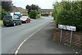
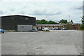
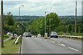
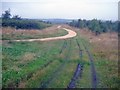

48 photos from this area
Area Information
Key information about the NG5 5DA including its size, population, and administrative classification.
- Area Type
- Postcode
- Area Size
- 13.4 hectares
- Population
- 2253
- Population Density
- 243 people/km²
House Prices in NG5 5DA
31
Properties
£156,812
Average Sold Price
£57,950
Lowest Price
£310,000
Highest Price
Showing 31 properties
| Address | Type | Beds | Baths | Last Sale Price | Last Sale Date | |
|---|---|---|---|---|---|---|
| 191 Brownlow Drive, Nottingham, NG5 5DA | Detached | 3 | 2 | £310,000 | Mar 2025 | |
| 199 Brownlow Drive, Nottingham, NG5 5DA | house | - | - | £285,000 | Jun 2021 | |
| 169 Brownlow Drive, Nottingham, NG5 5DA | house | - | - | £217,000 | Mar 2018 | |
| 165 Brownlow Drive, Nottingham, NG5 5DA | house | - | - | £184,950 | Apr 2017 | |
| 149 Brownlow Drive, Nottingham, NG5 5DA | Bungalow | 2 | - | £140,000 | Sep 2016 | |
| 193 Brownlow Drive, Nottingham, NG5 5DA | Detached | 3 | 1 | £166,000 | Aug 2016 | |
| 155 Brownlow Drive, Nottingham, NG5 5DA | Detached | 5 | 2 | £190,000 | Feb 2016 | |
| 205 Brownlow Drive, Nottingham, NG5 5DA | house | - | - | £140,000 | Mar 2015 | |
| 161 Brownlow Drive, Nottingham, NG5 5DA | Detached | 3 | - | £135,500 | Jul 2013 | |
| 157 Brownlow Drive, Nottingham, NG5 5DA | house | - | - | £150,000 | Jan 2013 |
Page 1 of 4
Energy Efficiency in NG5 5DA
Amenities
Schools
| Rank | School | Type | Entry gender | Ages |
|---|
Explore more schools in this area
Go to Schools tabDemographics
Household Size
Two person
most common
Accommodation Type
Houses
most common
Tenure
77
majority
Ethnic Group
White
most common
Religion
N/A
most common
Household Composition
N/A
most common
Age
47
median
Adults (30-64 years)
most common
Household Deprivation
N/A
with no deprivation
NS-SEC
32
in Lower managerial occupations
Explore more demographic insights in this area
Go to Demographics tabPlanning
Planning Constraints
- Flood RiskPremium
- Ramsar Wetland SitesPremium
- Area of Outstanding Natural BeautyPremium
- Protected Nature ReservePremium
- Protected WoodlandPremium