Area Overview for NG34 0HN
Photos of NG34 0HN
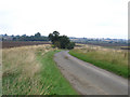
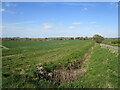


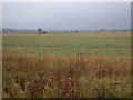

7 photos from this area
Area Information
Key information about the NG34 0HN including its size, population, and administrative classification.
- Area Type
- Postcode
- Area Size
- 37.3 hectares
- Population
- 2242
- Population Density
- 30 people/km²
House Prices in NG34 0HN
30
Properties
£332,000
Average Sold Price
£115,000
Lowest Price
£610,000
Highest Price
Showing 30 properties
| Address | Type | Beds | Baths | Last Sale Price | Last Sale Date | |
|---|---|---|---|---|---|---|
| Monks Cottage, Kirkby Underwood Road, Aslackby, NG34 0HN | Cottage | 6 | 3 | £610,000 | Dec 2025 | |
| Hill House, Kirkby Underwood Road, Aslackby, NG34 0HN | Detached | 3 | 1 | £350,000 | Aug 2025 | |
| Moorfield Cottage, Kirkby Underwood Road, Aslackby, NG34 0HN | house | - | - | £220,000 | Aug 2022 | |
| Church House, Kirkby Underwood Road, Aslackby, NG34 0HN | house | - | - | £570,000 | Mar 2022 | |
| The Pantiles, Kirkby Underwood Road, Aslackby, NG34 0HN | house | - | - | £365,000 | May 2021 | |
| Jasmine Cottage, Kirkby Underwood Road, Aslackby, NG34 0HN | Semi-detached | 3 | 1 | £242,000 | Feb 2019 | |
| The Olde Forge, Kirkby Underwood Road, Aslackby, NG34 0HN | Detached | 5 | - | £410,000 | Oct 2018 | |
| Woodbine Cottage, Kirkby Underwood Road, Aslackby, NG34 0HN | Semi-detached | 3 | 1 | £237,995 | Jun 2018 | |
| Blacksmiths Cottage, Kirkby Underwood Road, Aslackby, NG34 0HN | house | - | - | £335,000 | Sep 2004 | |
| The Old School, Kirkby Underwood Road, Aslackby, NG34 0HN | Detached | - | - | £197,000 | Dec 2001 |
Page 1 of 3
Energy Efficiency in NG34 0HN
Amenities
Schools
| Rank | School | Type | Entry gender | Ages |
|---|
Explore more schools in this area
Go to Schools tabDemographics
Household Size
Two person
most common
Accommodation Type
Houses
most common
Tenure
77
majority
Ethnic Group
White
most common
Religion
N/A
most common
Household Composition
N/A
most common
Age
47
median
Adults (30-64 years)
most common
Household Deprivation
N/A
with no deprivation
NS-SEC
37
in Lower managerial occupations
Explore more demographic insights in this area
Go to Demographics tabPlanning
Planning Constraints
- Flood RiskPremium
- Ramsar Wetland SitesPremium
- Area of Outstanding Natural BeautyPremium
- Protected Nature ReservePremium
- Protected WoodlandPremium