Area Overview for NG34 0HJ
Photos of NG34 0HJ
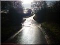
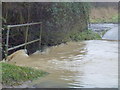
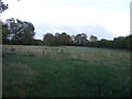
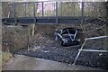
18 photos from this area
Area Information
Key information about the NG34 0HJ including its size, population, and administrative classification.
- Area Type
- Postcode
- Area Size
- 75.9 hectares
- Population
- 2242
- Population Density
- 30 people/km²
House Prices in NG34 0HJ
13
Properties
£258,928
Average Sold Price
£170,000
Lowest Price
£449,995
Highest Price
Showing 13 properties
| Address | Type | Beds | Baths | Last Sale Price | Last Sale Date | |
|---|---|---|---|---|---|---|
| Bakery Bungalow, Temple Road, Aslackby, NG34 0HJ | Bungalow | 3 | 1 | £170,000 | Sep 2023 | |
| Martins, 6 Temple Road, Aslackby, NG34 0HJ | Detached | 4 | 2 | £300,000 | Jul 2017 | |
| Cornercroft, Temple Road, Aslackby, NG34 0HJ | Bungalow | 4 | - | £248,000 | Oct 2015 | |
| High Bank, Temple Road, Aslackby, NG34 0HJ | Bungalow | 4 | - | £180,000 | Sep 2012 | |
| Spring Cottage, Temple Road, Aslackby, NG34 0HJ | Bungalow | 3 | - | £244,500 | Dec 2010 | |
| The Old Bakery, Temple Road, Aslackby, NG34 0HJ | Detached | 4 | 2 | £449,995 | May 2009 | |
| Meadowview, Temple Road, Aslackby, NG34 0HJ | Bungalow | - | - | £220,000 | Oct 2002 | |
| Moorfield House, Temple Road, Aslackby, NG34 0HJ | house | - | - | - | - | |
| Westside Cottage, 1 Temple Road, Aslackby, NG34 0HJ | house | - | - | - | - | |
| Manor Farm, Temple Road, Aslackby, NG34 0HJ | Office | - | - | - | - |
Page 1 of 2
Energy Efficiency in NG34 0HJ
Amenities
Schools
| Rank | School | Type | Entry gender | Ages |
|---|
Explore more schools in this area
Go to Schools tabDemographics
Household Size
Two person
most common
Accommodation Type
Houses
most common
Tenure
77
majority
Ethnic Group
White
most common
Religion
N/A
most common
Household Composition
N/A
most common
Age
47
median
Adults (30-64 years)
most common
Household Deprivation
N/A
with no deprivation
NS-SEC
37
in Lower managerial occupations
Explore more demographic insights in this area
Go to Demographics tabPlanning
Planning Constraints
- Flood RiskPremium
- Ramsar Wetland SitesPremium
- Area of Outstanding Natural BeautyPremium
- Protected Nature ReservePremium
- Protected WoodlandPremium