Area Overview for NG31 8TY
Photos of NG31 8TY
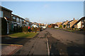
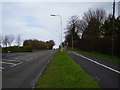
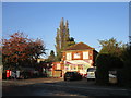
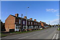
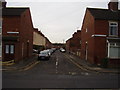
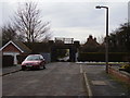
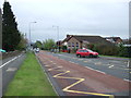
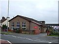
19 photos from this area
Area Information
Key information about the NG31 8TY including its size, population, and administrative classification.
- Area Type
- Postcode
- Area Size
- 1.2 hectares
- Population
- Not available
- Population Density
- Not available
House Prices in NG31 8TY
11
Properties
£399,650
Average Sold Price
£292,000
Lowest Price
£540,000
Highest Price
Showing 11 properties
| Address | Type | Beds | Baths | Last Sale Price | Last Sale Date | |
|---|---|---|---|---|---|---|
| The Grove, 11 Kings Gardens, Grantham, NG31 8TY | Bungalow | 3 | 1 | £384,000 | Sep 2019 | |
| Appletree House, 4 Kings Gardens, Grantham, NG31 8TY | Detached | 4 | 4 | £458,000 | Sep 2017 | |
| 1 Kings Gardens, Grantham, NG31 8TY | Detached | 5 | 4 | £392,500 | Nov 2015 | |
| 2 Kings Gardens, Grantham, NG31 8TY | house | 4 | - | £375,000 | Jul 2010 | |
| 5 Kings Gardens, Grantham, NG31 8TY | house | - | - | £330,000 | Mar 2010 | |
| 8 Kings Gardens, Grantham, NG31 8TY | house | 5 | - | £385,000 | Nov 2006 | |
| 6 Kings Gardens, Grantham, NG31 8TY | Detached | 5 | 4 | £540,000 | Nov 2006 | |
| The Cloisters, 10 Kings Gardens, Grantham, NG31 8TY | Detached | - | - | £385,000 | Nov 2006 | |
| 9 Kings Gardens, Grantham, NG31 8TY | Detached | - | - | £292,000 | Oct 2006 | |
| 3 Kings Gardens, Grantham, NG31 8TY | Detached | - | - | £455,000 | Jul 2006 |
Page 1 of 2
Energy Efficiency in NG31 8TY
Amenities
Schools
| Rank | School | Type | Entry gender | Ages |
|---|
Explore more schools in this area
Go to Schools tabDemographics
Household Size
One person
most common
Accommodation Type
Flats
most common
Tenure
38
majority
Ethnic Group
White
most common
Religion
N/A
most common
Household Composition
N/A
most common
Age
47
median
Adults (30-64 years)
most common
Household Deprivation
N/A
with no deprivation
NS-SEC
28
in Lower managerial occupations
Explore more demographic insights in this area
Go to Demographics tabPlanning
Planning Constraints
- Flood RiskPremium
- Ramsar Wetland SitesPremium
- Area of Outstanding Natural BeautyPremium
- Protected Nature ReservePremium
- Protected WoodlandPremium