Area Overview for NG31 8HU
Photos of NG31 8HU
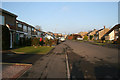
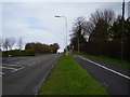
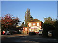
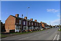

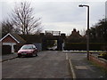
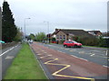
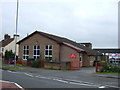
19 photos from this area
Area Information
Key information about the NG31 8HU including its size, population, and administrative classification.
- Area Type
- Postcode
- Area Size
- 5.0 hectares
- Population
- Not available
- Population Density
- Not available
House Prices in NG31 8HU
15
Properties
£318,601
Average Sold Price
£155,000
Lowest Price
£610,000
Highest Price
Showing 15 properties
| Address | Type | Beds | Baths | Last Sale Price | Last Sale Date | |
|---|---|---|---|---|---|---|
| Lynton, Gonerby Road, Grantham, NG31 8HU | house | - | - | £170,000 | Oct 2025 | |
| Whits End, Gonerby Road, Grantham, NG31 8HU | Detached | 4 | 2 | £610,000 | Mar 2025 | |
| Pyketts Lodge, Gonerby Road, Grantham, NG31 8HU | Detached | - | - | £490,000 | Oct 2022 | |
| Tree Tops, Gonerby Road, Grantham, NG31 8HU | Bungalow | - | - | £390,000 | Jan 2020 | |
| Royston, Gonerby Road, Grantham, NG31 8HU | Semi-detached | 3 | 1 | £155,000 | May 2017 | |
| Spring Croft, Gonerby Road, Grantham, NG31 8HU | Bungalow | 4 | 3 | £301,155 | Jul 2016 | |
| Upwood, Gonerby Road, Grantham, NG31 8HU | Detached | 3 | 1 | £290,000 | Jul 2014 | |
| Pine Tree Cottage, Gonerby Road, Grantham, NG31 8HU | Detached | - | - | £295,000 | Jun 2007 | |
| Ford End, Gonerby Road, Grantham, NG31 8HU | Detached | - | - | £166,250 | Aug 2004 | |
| Caravan At, Whits End, Gonerby Road, Grantham, NG31 8HU | Mobile Home | - | - | - | - |
Page 1 of 2
Energy Efficiency in NG31 8HU
Amenities
Schools
| Rank | School | Type | Entry gender | Ages |
|---|
Explore more schools in this area
Go to Schools tabDemographics
Household Size
One person
most common
Accommodation Type
Flats
most common
Tenure
38
majority
Ethnic Group
White
most common
Religion
N/A
most common
Household Composition
N/A
most common
Age
47
median
Adults (30-64 years)
most common
Household Deprivation
N/A
with no deprivation
NS-SEC
28
in Lower managerial occupations
Explore more demographic insights in this area
Go to Demographics tabPlanning
Planning Constraints
- Flood RiskPremium
- Ramsar Wetland SitesPremium
- Area of Outstanding Natural BeautyPremium
- Protected Nature ReservePremium
- Protected WoodlandPremium