Area Overview for NG31 8DQ
Photos of NG31 8DQ
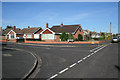
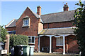
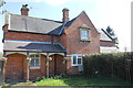
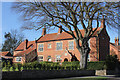
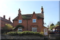
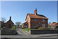
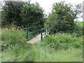
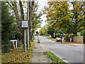
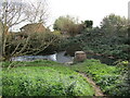
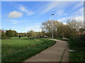
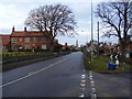
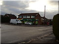
23 photos from this area
Area Information
Key information about the NG31 8DQ including its size, population, and administrative classification.
- Area Type
- Postcode
- Area Size
- 1.3 hectares
- Population
- 1304
- Population Density
- 2201 people/km²
House Prices in NG31 8DQ
11
Properties
£367,125
Average Sold Price
£120,000
Lowest Price
£745,000
Highest Price
Showing 11 properties
| Address | Type | Beds | Baths | Last Sale Price | Last Sale Date | |
|---|---|---|---|---|---|---|
| 123 Manthorpe Road, Grantham, NG31 8DQ | Detached | 5 | 6 | £745,000 | Aug 2024 | |
| 119 Manthorpe Road, Grantham, NG31 8DQ | Detached | 4 | 2 | £390,000 | Apr 2024 | |
| 127 Manthorpe Road, Grantham, NG31 8DQ | Bungalow | 3 | 1 | £360,000 | Mar 2022 | |
| 129 Manthorpe Road, Grantham, NG31 8DQ | Semi-detached | 4 | 1 | £330,000 | Sep 2017 | |
| 133 Manthorpe Road, Grantham, NG31 8DQ | house | 4 | - | £392,000 | Nov 2011 | |
| Brownlow House, 121 Manthorpe Road, Grantham, NG31 8DQ | house | - | - | £350,000 | Aug 2011 | |
| 115 Manthorpe Road, Grantham, NG31 8DQ | house | - | - | £250,000 | Jan 2010 | |
| 117 Manthorpe Road, Grantham, NG31 8DQ | Detached | 4 | 1 | £120,000 | Mar 1998 | |
| Annexe, 117 Manthorpe Road, Grantham, NG31 8DQ | Flat | - | - | - | - | |
| 131 Manthorpe Road, Grantham, NG31 8DQ | Semi-detached | - | - | - | - |
Page 1 of 2
Energy Efficiency in NG31 8DQ
Amenities
Schools
| Rank | School | Type | Entry gender | Ages |
|---|
Explore more schools in this area
Go to Schools tabDemographics
Household Size
Two person
most common
Accommodation Type
Houses
most common
Tenure
91
majority
Ethnic Group
White
most common
Religion
N/A
most common
Household Composition
N/A
most common
Age
47
median
Adults (30-64 years)
most common
Household Deprivation
N/A
with no deprivation
NS-SEC
36
in Lower managerial occupations
Explore more demographic insights in this area
Go to Demographics tabPlanning
Planning Constraints
- Flood RiskPremium
- Ramsar Wetland SitesPremium
- Area of Outstanding Natural BeautyPremium
- Protected Nature ReservePremium
- Protected WoodlandPremium