Area Overview for NG31 8DL
Photos of NG31 8DL
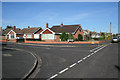
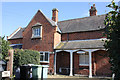
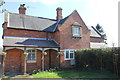
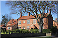
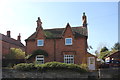
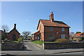
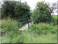
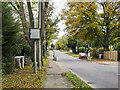
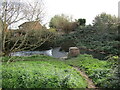
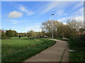
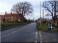
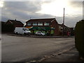
23 photos from this area
Area Information
Key information about the NG31 8DL including its size, population, and administrative classification.
- Area Type
- Postcode
- Area Size
- 11.7 hectares
- Population
- 1304
- Population Density
- 2201 people/km²
House Prices in NG31 8DL
32
Properties
£343,395
Average Sold Price
£130,000
Lowest Price
£580,000
Highest Price
Showing 32 properties
| Address | Type | Beds | Baths | Last Sale Price | Last Sale Date | |
|---|---|---|---|---|---|---|
| 116 Manthorpe Road, Grantham, NG31 8DL | Detached | - | - | £580,000 | Dec 2023 | |
| 146 Manthorpe Road, Grantham, NG31 8DL | Detached | 4 | 2 | £532,500 | Oct 2023 | |
| 128 Manthorpe Road, Grantham, NG31 8DL | Detached | 4 | 3 | £570,000 | Nov 2022 | |
| 124 Manthorpe Road, Grantham, NG31 8DL | Detached | 5 | 3 | £526,500 | Mar 2022 | |
| 112 Manthorpe Road, Grantham, NG31 8DL | Detached | 3 | 2 | £335,000 | Aug 2020 | |
| 102 Manthorpe Road, Grantham, NG31 8DL | Detached | 3 | 2 | £310,000 | Nov 2019 | |
| 132 Manthorpe Road, Grantham, NG31 8DL | Detached | 4 | 1 | £490,000 | Feb 2019 | |
| 152 Manthorpe Road, Grantham, NG31 8DL | Detached | 4 | 1 | £400,000 | Mar 2018 | |
| 110 Manthorpe Road, Grantham, NG31 8DL | Detached | 4 | 2 | £348,000 | Jun 2016 | |
| 130 Manthorpe Road, Grantham, NG31 8DL | house | 4 | - | £395,000 | Nov 2013 |
Page 1 of 4
Energy Efficiency in NG31 8DL
Amenities
Schools
| Rank | School | Type | Entry gender | Ages |
|---|
Explore more schools in this area
Go to Schools tabDemographics
Household Size
Two person
most common
Accommodation Type
Houses
most common
Tenure
91
majority
Ethnic Group
White
most common
Religion
N/A
most common
Household Composition
N/A
most common
Age
47
median
Adults (30-64 years)
most common
Household Deprivation
N/A
with no deprivation
NS-SEC
36
in Lower managerial occupations
Explore more demographic insights in this area
Go to Demographics tabPlanning
Planning Constraints
- Flood RiskPremium
- Ramsar Wetland SitesPremium
- Area of Outstanding Natural BeautyPremium
- Protected Nature ReservePremium
- Protected WoodlandPremium