Area Overview for NG3 5JL
Photos of NG3 5JL
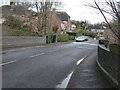
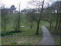
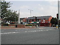
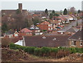
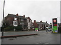
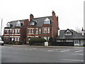
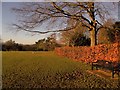
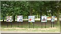
64 photos from this area
Area Information
Key information about the NG3 5JL including its size, population, and administrative classification.
- Area Type
- Postcode
- Area Size
- 2.4 hectares
- Population
- 1347
- Population Density
- 4554 people/km²
House Prices in NG3 5JL
19
Properties
£302,541
Average Sold Price
£155,000
Lowest Price
£500,000
Highest Price
Showing 19 properties
| Address | Type | Beds | Baths | Last Sale Price | Last Sale Date | |
|---|---|---|---|---|---|---|
| 123 Woodthorpe Drive, Woodthorpe, NG3 5JL | Detached | 3 | 2 | £485,000 | Feb 2025 | |
| 117 Woodthorpe Drive, Woodthorpe, NG3 5JL | house | - | - | £500,000 | Jan 2021 | |
| 129 Woodthorpe Drive, Woodthorpe, NG3 5JL | Semi-detached | 3 | 1 | £211,000 | Aug 2020 | |
| 133 Woodthorpe Drive, Woodthorpe, NG3 5JL | Semi-detached | 4 | 2 | £262,000 | Aug 2019 | |
| 137 Woodthorpe Drive, Woodthorpe, NG3 5JL | Detached | 4 | 2 | £350,000 | Oct 2018 | |
| 131 Woodthorpe Drive, Woodthorpe, NG3 5JL | house | - | - | £155,000 | Oct 2015 | |
| 127 Woodthorpe Drive, Woodthorpe, NG3 5JL | Semi-detached | 3 | - | £165,000 | Jun 2014 | |
| 135 Woodthorpe Drive, Woodthorpe, NG3 5JL | house | - | - | £238,000 | Jun 2012 | |
| 139 Woodthorpe Drive, Woodthorpe, NG3 5JL | house | 4 | - | £395,000 | Oct 2011 | |
| 141 Woodthorpe Drive, Woodthorpe, NG3 5JL | Detached | 5 | 3 | £375,000 | Dec 2010 |
Page 1 of 2
Energy Efficiency in NG3 5JL
Amenities
Schools
| Rank | School | Type | Entry gender | Ages |
|---|
Explore more schools in this area
Go to Schools tabDemographics
Household Size
Family (3-5 people)
most common
Accommodation Type
Houses
most common
Tenure
94
majority
Ethnic Group
White
most common
Religion
N/A
most common
Household Composition
N/A
most common
Age
47
median
Adults (30-64 years)
most common
Household Deprivation
N/A
with no deprivation
NS-SEC
52
in Lower managerial occupations
Explore more demographic insights in this area
Go to Demographics tabPlanning
Planning Constraints
- Flood RiskPremium
- Ramsar Wetland SitesPremium
- Area of Outstanding Natural BeautyPremium
- Protected Nature ReservePremium
- Protected WoodlandPremium