Area Overview for NG25 0DB
Photos of NG25 0DB
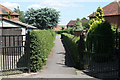

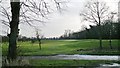
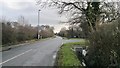
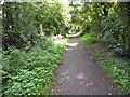
50 photos from this area
Area Information
Key information about the NG25 0DB including its size, population, and administrative classification.
- Area Type
- Postcode
- Area Size
- 7702 m²
- Population
- 2135
- Population Density
- 2082 people/km²
House Prices in NG25 0DB
20
Properties
£224,112
Average Sold Price
£79,950
Lowest Price
£425,000
Highest Price
Showing 20 properties
| Address | Type | Beds | Baths | Last Sale Price | Last Sale Date | |
|---|---|---|---|---|---|---|
| 16 Fern Close, Southwell, NG25 0DB | Bungalow | 2 | 2 | £365,000 | Dec 2024 | |
| 20 Fern Close, Southwell, NG25 0DB | Bungalow | 2 | 1 | £425,000 | Jan 2022 | |
| 3 Fern Close, Southwell, NG25 0DB | house | 4 | - | £282,500 | Oct 2020 | |
| 13 Fern Close, Southwell, NG25 0DB | Bungalow | 2 | 1 | £265,000 | Dec 2018 | |
| 9 Fern Close, Southwell, NG25 0DB | Bungalow | - | - | £180,000 | Mar 2016 | |
| 17 Fern Close, Southwell, NG25 0DB | Bungalow | 3 | - | £240,000 | Feb 2012 | |
| 2 Fern Close, Southwell, NG25 0DB | house | - | - | £211,500 | Mar 2011 | |
| 1 Fern Close, Southwell, NG25 0DB | house | - | - | £225,000 | Jul 2009 | |
| 8 Fern Close, Southwell, NG25 0DB | Detached | - | - | £225,000 | Feb 2007 | |
| 14 Fern Close, Southwell, NG25 0DB | Detached | - | - | £174,000 | Jun 2005 |
Page 1 of 2
Energy Efficiency in NG25 0DB
Amenities
Schools
| Rank | School | Type | Entry gender | Ages |
|---|
Explore more schools in this area
Go to Schools tabDemographics
Household Size
Two person
most common
Accommodation Type
Houses
most common
Tenure
81
majority
Ethnic Group
White
most common
Religion
N/A
most common
Household Composition
N/A
most common
Age
47
median
Adults (30-64 years)
most common
Household Deprivation
N/A
with no deprivation
NS-SEC
40
in Lower managerial occupations
Explore more demographic insights in this area
Go to Demographics tabPlanning
Planning Constraints
- Flood RiskPremium
- Ramsar Wetland SitesPremium
- Area of Outstanding Natural BeautyPremium
- Protected Nature ReservePremium
- Protected WoodlandPremium