Area Overview for NG24 3EQ
Photos of NG24 3EQ
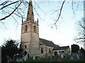
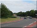
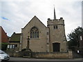
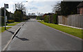
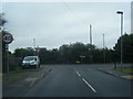
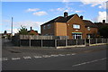
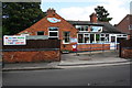
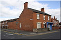
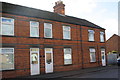
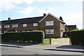
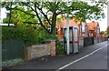
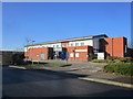
61 photos from this area
Area Information
Key information about the NG24 3EQ including its size, population, and administrative classification.
- Area Type
- Postcode
- Area Size
- 1.4 hectares
- Population
- 2074
- Population Density
- 1435 people/km²
House Prices in NG24 3EQ
38
Properties
£110,050
Average Sold Price
£39,995
Lowest Price
£186,000
Highest Price
Showing 38 properties
| Address | Type | Beds | Baths | Last Sale Price | Last Sale Date | |
|---|---|---|---|---|---|---|
| 37 Stafford Avenue, Balderton, NG24 3EQ | Terraced | 3 | 1 | £150,500 | Nov 2024 | |
| 49 Stafford Avenue, Balderton, NG24 3EQ | Terraced | 3 | 1 | £158,000 | Jun 2024 | |
| 31 Stafford Avenue, Balderton, NG24 3EQ | Terraced | 3 | 1 | £175,000 | Oct 2023 | |
| 41 Stafford Avenue, Balderton, NG24 3EQ | house | - | - | £165,000 | Jun 2023 | |
| 43 Stafford Avenue, Balderton, NG24 3EQ | Terraced | 3 | 1 | £186,000 | Sep 2022 | |
| 65 Stafford Avenue, Balderton, NG24 3EQ | Terraced | 3 | 1 | £135,000 | Dec 2021 | |
| 51 Stafford Avenue, Balderton, NG24 3EQ | house | 3 | 1 | £142,000 | Jun 2019 | |
| 35 Stafford Avenue, Balderton, NG24 3EQ | house | - | - | £114,000 | Feb 2019 | |
| 29 Stafford Avenue, Balderton, NG24 3EQ | house | - | - | £140,000 | Feb 2019 | |
| 73 Stafford Avenue, Balderton, NG24 3EQ | Terraced | 3 | 1 | £132,000 | Sep 2018 |
Page 1 of 4
Energy Efficiency in NG24 3EQ
Amenities
Schools
| Rank | School | Type | Entry gender | Ages |
|---|
Explore more schools in this area
Go to Schools tabDemographics
Household Size
Two person
most common
Accommodation Type
Houses
most common
Tenure
73
majority
Ethnic Group
White
most common
Religion
N/A
most common
Household Composition
N/A
most common
Age
47
median
Adults (30-64 years)
most common
Household Deprivation
N/A
with no deprivation
NS-SEC
29
in Lower managerial occupations
Explore more demographic insights in this area
Go to Demographics tabPlanning
Planning Constraints
- Flood RiskPremium
- Ramsar Wetland SitesPremium
- Area of Outstanding Natural BeautyPremium
- Protected Nature ReservePremium
- Protected WoodlandPremium