Area Overview for NG24 3EG
Photos of NG24 3EG
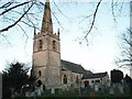
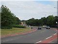
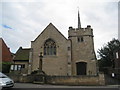
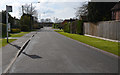
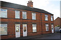
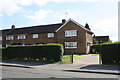
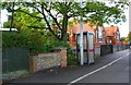
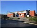
61 photos from this area
Area Information
Key information about the NG24 3EG including its size, population, and administrative classification.
- Area Type
- Postcode
- Area Size
- 1.6 hectares
- Population
- 2074
- Population Density
- 1435 people/km²
House Prices in NG24 3EG
39
Properties
£143,672
Average Sold Price
£89,500
Lowest Price
£210,000
Highest Price
Showing 39 properties
| Address | Type | Beds | Baths | Last Sale Price | Last Sale Date | |
|---|---|---|---|---|---|---|
| 20 Stafford Avenue, Balderton, NG24 3EG | Detached | 3 | 2 | £129,550 | Oct 2025 | |
| 80 Stafford Avenue, Balderton, NG24 3EG | Terraced | 3 | 1 | £160,000 | May 2025 | |
| 52 Stafford Avenue, Balderton, NG24 3EG | Terraced | 3 | 1 | £210,000 | Jan 2024 | |
| 42 Stafford Avenue, Balderton, NG24 3EG | Semi-detached | 3 | 1 | £172,000 | Sep 2023 | |
| 76 Stafford Avenue, Balderton, NG24 3EG | house | - | - | £160,000 | Jul 2023 | |
| 58 Stafford Avenue, Balderton, NG24 3EG | house | - | - | £118,000 | Nov 2018 | |
| 70 Stafford Avenue, Balderton, NG24 3EG | Terraced | 3 | 1 | £147,000 | Aug 2018 | |
| 28 Stafford Avenue, Balderton, NG24 3EG | house | 3 | 1 | £107,000 | Aug 2018 | |
| 84 Stafford Avenue, Balderton, NG24 3EG | house | 3 | - | £89,500 | Sep 2010 | |
| 26 Stafford Avenue, Balderton, NG24 3EG | Terraced | - | - | - | - |
Page 1 of 4
Energy Efficiency in NG24 3EG
Amenities
Schools
| Rank | School | Type | Entry gender | Ages |
|---|
Explore more schools in this area
Go to Schools tabDemographics
Household Size
Two person
most common
Accommodation Type
Houses
most common
Tenure
73
majority
Ethnic Group
White
most common
Religion
N/A
most common
Household Composition
N/A
most common
Age
47
median
Adults (30-64 years)
most common
Household Deprivation
N/A
with no deprivation
NS-SEC
29
in Lower managerial occupations
Explore more demographic insights in this area
Go to Demographics tabPlanning
Planning Constraints
- Flood RiskPremium
- Ramsar Wetland SitesPremium
- Area of Outstanding Natural BeautyPremium
- Protected Nature ReservePremium
- Protected WoodlandPremium