Area Overview for NG21 0TL
Photos of NG21 0TL
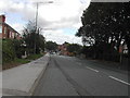
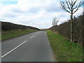
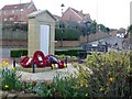
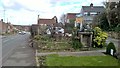
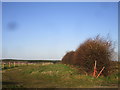
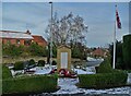
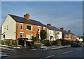
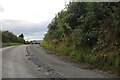
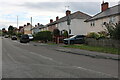
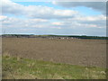

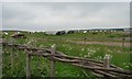
16 photos from this area
Area Information
Key information about the NG21 0TL including its size, population, and administrative classification.
- Area Type
- Postcode
- Area Size
- 5.1 hectares
- Population
- 1454
- Population Density
- 232 people/km²
House Prices in NG21 0TL
32
Properties
£100,396
Average Sold Price
£30,000
Lowest Price
£166,500
Highest Price
Showing 32 properties
| Address | Type | Beds | Baths | Last Sale Price | Last Sale Date | |
|---|---|---|---|---|---|---|
| 84 Oak Avenue, Blidworth, NG21 0TL | house | - | - | £116,666 | Oct 2022 | |
| 28 Oak Avenue, Blidworth, NG21 0TL | house | - | - | £166,500 | Jan 2022 | |
| 74 Oak Avenue, Blidworth, NG21 0TL | house | - | - | £166,000 | Sep 2021 | |
| 30 Oak Avenue, Blidworth, NG21 0TL | Semi-detached | 3 | 1 | £135,000 | May 2019 | |
| 64 Oak Avenue, Blidworth, NG21 0TL | Flat | - | - | £49,000 | Jan 2011 | |
| 36 Oak Avenue, Blidworth, NG21 0TL | Semi-detached | - | - | £30,000 | May 2009 | |
| 82 Oak Avenue, Blidworth, NG21 0TL | Semi-detached | - | - | £75,000 | Apr 2003 | |
| 38 Oak Avenue, Blidworth, NG21 0TL | Semi-detached | 3 | - | £65,000 | Oct 2002 | |
| 62 Oak Avenue, Blidworth, NG21 0TL | Flat | 2 | 1 | - | - | |
| 80 Oak Avenue, Blidworth, NG21 0TL | house | 3 | - | - | - |
Page 1 of 4
Energy Efficiency in NG21 0TL
Amenities
Schools
| Rank | School | Type | Entry gender | Ages |
|---|
Explore more schools in this area
Go to Schools tabDemographics
Household Size
One person
most common
Accommodation Type
Houses
most common
Tenure
57
majority
Ethnic Group
White
most common
Religion
N/A
most common
Household Composition
N/A
most common
Age
47
median
Adults (30-64 years)
most common
Household Deprivation
N/A
with no deprivation
NS-SEC
22
in Lower managerial occupations
Explore more demographic insights in this area
Go to Demographics tabPlanning
Planning Constraints
- Flood RiskPremium
- Ramsar Wetland SitesPremium
- Area of Outstanding Natural BeautyPremium
- Protected Nature ReservePremium
- Protected WoodlandPremium