Area Overview for NG18 4YT
Photos of NG18 4YT
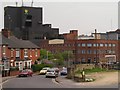

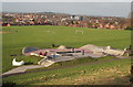

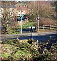
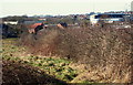

43 photos from this area
Area Information
Key information about the NG18 4YT including its size, population, and administrative classification.
- Area Type
- Postcode
- Area Size
- 1.8 hectares
- Population
- 1439
- Population Density
- 5681 people/km²
House Prices in NG18 4YT
74
Properties
£144,074
Average Sold Price
£72,000
Lowest Price
£259,995
Highest Price
Showing 74 properties
| Address | Type | Beds | Baths | Last Sale Price | Last Sale Date | |
|---|---|---|---|---|---|---|
| 28 Scholars Way, Mansfield, NG18 4YT | Flat | 2 | 1 | £110,000 | Jun 2025 | |
| 32 Scholars Way, Mansfield, NG18 4YT | Semi-detached | 3 | 3 | £205,000 | Nov 2024 | |
| 65 Scholars Way, Mansfield, NG18 4YT | Maisonette | 2 | 1 | £135,500 | Jan 2024 | |
| 34 Scholars Way, Mansfield, NG18 4YT | Terraced | 4 | 3 | £222,000 | Dec 2023 | |
| 16 Scholars Way, Mansfield, NG18 4YT | Semi-detached | 3 | 3 | £219,000 | Oct 2023 | |
| 9 Scholars Way, Mansfield, NG18 4YT | Detached | 2 | 1 | £137,500 | Sep 2023 | |
| 33 Scholars Way, Mansfield, NG18 4YT | house | 3 | 2 | £183,000 | Aug 2023 | |
| 59 Scholars Way, Mansfield, NG18 4YT | Detached | 3 | 2 | £232,500 | Aug 2023 | |
| 39 Scholars Way, Mansfield, NG18 4YT | Flat | 2 | 1 | £115,000 | Nov 2022 | |
| 38 Scholars Way, Mansfield, NG18 4YT | Terraced | 4 | 3 | £215,000 | Nov 2022 |
Page 1 of 8
Energy Efficiency in NG18 4YT
Amenities
Schools
| Rank | School | Type | Entry gender | Ages |
|---|
Explore more schools in this area
Go to Schools tabDemographics
Household Size
Family (3-5 people)
most common
Accommodation Type
Houses
most common
Tenure
63
majority
Ethnic Group
White
most common
Religion
N/A
most common
Household Composition
N/A
most common
Age
47
median
Adults (30-64 years)
most common
Household Deprivation
N/A
with no deprivation
NS-SEC
36
in Lower managerial occupations
Explore more demographic insights in this area
Go to Demographics tabPlanning
Planning Constraints
- Flood RiskPremium
- Ramsar Wetland SitesPremium
- Area of Outstanding Natural BeautyPremium
- Protected Nature ReservePremium
- Protected WoodlandPremium