Area Overview for NG18 4YF
Photos of NG18 4YF
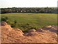
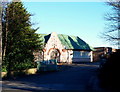
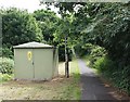
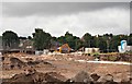
32 photos from this area
Area Information
Key information about the NG18 4YF including its size, population, and administrative classification.
- Area Type
- Postcode
- Area Size
- 1.5 hectares
- Population
- 1699
- Population Density
- 5658 people/km²
House Prices in NG18 4YF
44
Properties
£170,654
Average Sold Price
£84,995
Lowest Price
£326,000
Highest Price
Showing 44 properties
| Address | Type | Beds | Baths | Last Sale Price | Last Sale Date | |
|---|---|---|---|---|---|---|
| 32 White Rose Avenue, Mansfield, NG18 4YF | Detached | 4 | 3 | £316,000 | Jul 2025 | |
| 10 White Rose Avenue, Mansfield, NG18 4YF | house | 4 | 3 | £326,000 | Jul 2025 | |
| 43 White Rose Avenue, Mansfield, NG18 4YF | Detached | 4 | 2 | £270,000 | Apr 2025 | |
| 9 White Rose Avenue, Mansfield, NG18 4YF | Semi-detached | 3 | 2 | £116,000 | Aug 2022 | |
| 24 White Rose Avenue, Mansfield, NG18 4YF | house | - | - | £180,000 | Jun 2022 | |
| 38 White Rose Avenue, Mansfield, NG18 4YF | Detached | 4 | 3 | £325,000 | Mar 2022 | |
| 22 White Rose Avenue, Mansfield, NG18 4YF | Semi-detached | 3 | 3 | £165,000 | Sep 2021 | |
| 45 White Rose Avenue, Mansfield, NG18 4YF | Detached | 4 | 3 | £280,000 | Mar 2021 | |
| 2 White Rose Avenue, Mansfield, NG18 4YF | Flat | - | - | £95,000 | Jun 2019 | |
| 6 White Rose Avenue, Mansfield, NG18 4YF | Detached | 4 | - | £215,000 | May 2019 |
Page 1 of 5
Energy Efficiency in NG18 4YF
Amenities
Schools
| Rank | School | Type | Entry gender | Ages |
|---|
Explore more schools in this area
Go to Schools tabDemographics
Household Size
Family (3-5 people)
most common
Accommodation Type
Houses
most common
Tenure
73
majority
Ethnic Group
White
most common
Religion
N/A
most common
Household Composition
N/A
most common
Age
47
median
Adults (30-64 years)
most common
Household Deprivation
N/A
with no deprivation
NS-SEC
43
in Lower managerial occupations
Explore more demographic insights in this area
Go to Demographics tabPlanning
Planning Constraints
- Flood RiskPremium
- Ramsar Wetland SitesPremium
- Area of Outstanding Natural BeautyPremium
- Protected Nature ReservePremium
- Protected WoodlandPremium