Area Overview for NG17 1JR
Photos of NG17 1JR


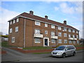


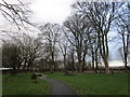
39 photos from this area
Area Information
Key information about the NG17 1JR including its size, population, and administrative classification.
- Area Type
- Postcode
- Area Size
- 8935 m²
- Population
- 2625
- Population Density
- 1992 people/km²
House Prices in NG17 1JR
18
Properties
£142,896
Average Sold Price
£63,000
Lowest Price
£310,000
Highest Price
Showing 18 properties
| Address | Type | Beds | Baths | Last Sale Price | Last Sale Date | |
|---|---|---|---|---|---|---|
| 1 Coalfield Close, Sutton In Ashfield, NG17 1JR | Detached | 4 | 3 | £310,000 | Aug 2023 | |
| 26 Coalfield Close, Sutton In Ashfield, NG17 1JR | Detached | 3 | 2 | £165,000 | Feb 2017 | |
| 5 Coalfield Close, Sutton In Ashfield, NG17 1JR | Detached | 4 | - | £210,000 | Sep 2014 | |
| 24 Coalfield Close, Sutton In Ashfield, NG17 1JR | house | 3 | - | £145,000 | Feb 2011 | |
| 9 Coalfield Close, Sutton In Ashfield, NG17 1JR | house | - | - | £160,000 | Jan 2010 | |
| 14 Coalfield Close, Sutton In Ashfield, NG17 1JR | house | - | - | £144,000 | Jun 2009 | |
| 16 Coalfield Close, Sutton In Ashfield, NG17 1JR | Detached | - | - | £172,000 | Aug 2008 | |
| 22 Coalfield Close, Sutton In Ashfield, NG17 1JR | Detached | - | - | £175,000 | Jan 2008 | |
| 3 Coalfield Close, Sutton In Ashfield, NG17 1JR | Detached | - | - | £191,000 | Nov 2006 | |
| 18 Coalfield Close, Sutton In Ashfield, NG17 1JR | house | - | - | £150,000 | Jan 2006 |
Page 1 of 2
Energy Efficiency in NG17 1JR
Amenities
Schools
| Rank | School | Type | Entry gender | Ages |
|---|
Explore more schools in this area
Go to Schools tabDemographics
Household Size
Family (3-5 people)
most common
Accommodation Type
Houses
most common
Tenure
87
majority
Ethnic Group
White
most common
Religion
N/A
most common
Household Composition
N/A
most common
Age
47
median
Adults (30-64 years)
most common
Household Deprivation
N/A
with no deprivation
NS-SEC
39
in Lower managerial occupations
Explore more demographic insights in this area
Go to Demographics tabPlanning
Planning Constraints
- Flood RiskPremium
- Ramsar Wetland SitesPremium
- Area of Outstanding Natural BeautyPremium
- Protected Nature ReservePremium
- Protected WoodlandPremium