Area Overview for NG17 1HL
Photos of NG17 1HL


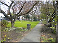
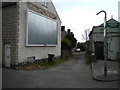
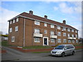


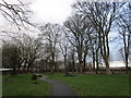
Area Information
NG17 1HL is a compact residential postcode in England, covering just 1.1 hectares and home to 2,625 residents. This small area is characterised by its dense population—over 1,992 people per square kilometre—suggesting a tightly knit community. The area is predominantly occupied by adults aged 30 to 64, with a median age of 47, indicating a mature, stable population. Most residents own their homes, with 87% of properties in private ownership, and the accommodation is largely houses rather than flats. Living here means proximity to essential services: five retail outlets, including Tesco Sutton and Co-op Sutton, and five rail stations, such as Sutton Parkway and Mansfield, offering easy access to nearby towns. The area’s low crime risk score of 79 and no flood or environmental hazards make it appealing for families and professionals seeking safety and convenience. Despite its small size, NG17 1HL balances urban accessibility with a quiet, residential feel, ideal for those prioritising security and connectivity.
- Area Type
- Postcode
- Area Size
- 1.1 hectares
- Population
- 2625
- Population Density
- 1992 people/km²
The property market in NG17 1HL is dominated by owner-occupied homes, with 87% of properties privately owned. This high ownership rate indicates a community of long-term residents rather than a rental-focused area. The accommodation is predominantly houses, which are more common than flats in this postcode. Given the area’s small size—just 1.1 hectares—the housing stock is limited, making it a niche market for buyers seeking a compact, established residential environment. The proximity to rail stations such as Sutton Parkway and Mansfield, along with nearby retail amenities, adds to the area’s appeal for those prioritising connectivity and convenience. However, the limited space means competition for properties is likely, and buyers should consider the immediate surroundings for additional options. The focus on houses suggests a demand for family homes or larger living spaces, though the exact availability of property types is not detailed.
House Prices in NG17 1HL
Showing 19 properties
| Address | Type | Beds | Baths | Last Sale Price | Last Sale Date | |
|---|---|---|---|---|---|---|
| 3 Woodlands Way, Sutton In Ashfield, NG17 1HL | Detached | 4 | 2 | £315,000 | Feb 2025 | |
| 25 Woodlands Way, Sutton In Ashfield, NG17 1HL | house | - | - | £275,000 | Nov 2021 | |
| 23 Woodlands Way, Sutton In Ashfield, NG17 1HL | Detached | 4 | 1 | £242,000 | Sep 2019 | |
| 5 Woodlands Way, Sutton In Ashfield, NG17 1HL | Detached | 4 | 2 | £252,500 | Oct 2018 | |
| 10 Woodlands Way, Sutton In Ashfield, NG17 1HL | Detached | 4 | 1 | £250,000 | Dec 2017 | |
| 8 Woodlands Way, Sutton In Ashfield, NG17 1HL | Detached | 4 | 2 | £235,000 | Jun 2016 | |
| 9 Woodlands Way, Sutton In Ashfield, NG17 1HL | house | - | - | £170,000 | Mar 2014 | |
| 21 Woodlands Way, Sutton In Ashfield, NG17 1HL | house | - | - | £149,000 | Aug 2010 | |
| 2 Woodlands Way, Sutton In Ashfield, NG17 1HL | Detached | - | - | £220,000 | Jul 2004 | |
| 14 Woodlands Way, Sutton In Ashfield, NG17 1HL | Detached | - | - | £187,000 | Jul 2004 |
Energy Efficiency in NG17 1HL
Living in NG17 1HL offers access to a range of nearby amenities within practical reach. The area is served by five retail outlets, including Tesco Sutton and Co-op Sutton, providing essential shopping options for daily needs. Rail stations such as Sutton Parkway and Mansfield are within easy distance, offering convenient commuting links to surrounding areas. While the area is small, its proximity to these services ensures residents can access both local and regional facilities without long journeys. The presence of multiple retail options and rail connections contributes to a practical, efficient lifestyle, ideal for those who value accessibility. The compact nature of the postcode means the community is close-knit, with amenities concentrated in a way that supports a balanced daily routine.
Amenities
Schools
| Rank | School | Type | Entry gender | Ages |
|---|
Explore more schools in this area
Go to Schools tabDemographics
The community in NG17 1HL is predominantly composed of adults aged 30 to 64, with a median age of 47. This suggests a population that is largely established, with many likely to be in their prime working years or nearing retirement. Home ownership is exceptionally high at 87%, reflecting a stable, long-term resident base rather than a transient rental market. The area is dominated by houses rather than flats, indicating a preference for traditional, family-friendly housing. The predominant ethnic group is White, though no further diversity data is provided. With 2,625 residents in such a small area, the community is closely knit, and the high ownership rate implies a shared commitment to local stability. The absence of specific data on deprivation means the quality of life remains unquantified, but the low crime risk and lack of environmental constraints suggest a generally secure and well-maintained environment.
Household Size
Accommodation Type
Tenure
Ethnic Group
Religion
Household Composition
Age
Household Deprivation
NS-SEC
Explore more demographic insights in this area
Go to Demographics tabPlanning
Planning Constraints
- Flood RiskPremium
- Ramsar Wetland SitesPremium
- Area of Outstanding Natural BeautyPremium
- Protected Nature ReservePremium
- Protected WoodlandPremium