Area Overview for NG17 1JJ
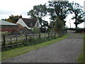
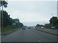
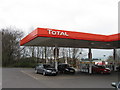
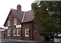
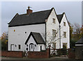
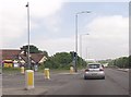
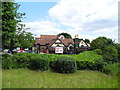
Photos of NG17 1JJ


Area Information
Living in NG17 1JJ offers a compact, residential experience shaped by its small area size of 3,258 m² and a population of 2,625. This postcode covers a tightly knit cluster of homes, with a population density of 1,992 people per km², suggesting a close-knit community. The area is predominantly occupied by adults aged 30–64, with a median age of 47, indicating a stable demographic. Home ownership is high at 87%, with most properties being houses rather than flats. This suggests a traditional, family-oriented environment. The absence of major planning constraints, such as protected woodlands or AONB areas, means development is not restricted. Residents benefit from low flood risk and below-average crime rates, making it a secure place to live. The proximity to rail networks and retail hubs adds practicality to daily life, while the area’s small size ensures a sense of familiarity. For those seeking a quiet, established neighbourhood with straightforward infrastructure, NG17 1JJ provides a straightforward, low-maintenance lifestyle.
- Area Type
- Postcode
- Area Size
- 3258 m²
- Population
- 2625
- Population Density
- 1992 people/km²
The property market in NG17 1JJ is characterised by high home ownership—87% of residents own their homes—and a predominance of houses over flats. This suggests a market skewed towards owner-occupation rather than rental demand, which may influence property values and investment potential. The small area size and compact layout mean the housing stock is limited, with no indication of large-scale development. For buyers, this implies a focus on individual properties rather than high-density housing. The absence of planning constraints, such as protected nature reserves or AONB areas, allows for more flexibility in property use. However, the small size of the area means competition for available homes could be keen. Buyers should consider the proximity to rail networks and retail amenities, which enhance the practicality of living here. The market appears stable, with a clear emphasis on established, owner-occupied housing.
House Prices in NG17 1JJ
Showing 9 properties
| Address | Type | Beds | Baths | Last Sale Price | Last Sale Date | |
|---|---|---|---|---|---|---|
| 355 Alfreton Road, Sutton In Ashfield, NG17 1JJ | Semi-detached | 3 | 1 | £130,000 | Jun 2022 | |
| 349 Alfreton Road, Sutton In Ashfield, NG17 1JJ | Semi-detached | 3 | 1 | £165,000 | Mar 2019 | |
| 353 Alfreton Road, Sutton In Ashfield, NG17 1JJ | Semi-detached | 3 | 2 | £130,000 | Jun 2016 | |
| 359 Alfreton Road, Sutton In Ashfield, NG17 1JJ | house | - | - | £76,500 | Nov 2009 | |
| 365 Alfreton Road, Sutton In Ashfield, NG17 1JJ | Detached | - | - | - | - | |
| 363 Alfreton Road, Sutton In Ashfield, NG17 1JJ | house | - | - | - | - | |
| 361 Alfreton Road, Sutton In Ashfield, NG17 1JJ | Semi-detached | - | - | - | - | |
| 357 Alfreton Road, Sutton In Ashfield, NG17 1JJ | Semi-detached | - | - | - | - | |
| 351 Alfreton Road, Sutton In Ashfield, NG17 1JJ | Semi-detached | - | - | - | - |
Energy Efficiency in NG17 1JJ
Residents of NG17 1JJ have access to a range of nearby amenities, including five retail outlets such as Spar, Tesco Sutton, and Co-op Sutton. These shops provide everyday essentials, reducing the need for long journeys. The rail network is particularly well-served, with five stations within practical reach, including Kirkby in Ashfield and Sutton Parkway. These stations connect the area to broader transport routes, enhancing mobility. While the data does not specify parks or leisure facilities, the proximity to rail and retail suggests a functional, community-focused lifestyle. The small area size means amenities are closely clustered, offering convenience without the sprawl of larger towns. For those valuing accessibility and practicality, NG17 1JJ provides a straightforward, no-frills approach to daily living, with shops and transport within easy reach.
Amenities
Schools
| Rank | School | Type | Entry gender | Ages |
|---|
Explore more schools in this area
Go to Schools tabDemographics
The community in NG17 1JJ is defined by its adult population, with 87% of residents owning their homes. The median age of 47 and the dominance of the 30–64 age group suggest a mature, settled population, likely with long-term ties to the area. The predominant ethnic group is White, reflecting the broader regional demographic. With 87% home ownership, the area leans towards owner-occupied properties rather than rentals, which may influence local dynamics and property values. The high population density of 1,992 people per km², combined with the small area size, means the community is closely packed, fostering a sense of proximity and shared space. While no specific data on deprivation is provided, the low crime score of 79/100 and absence of environmental constraints imply a stable, low-risk living environment. This profile aligns with a neighbourhood where long-term residents outnumber transients, creating a consistent social fabric.
Household Size
Accommodation Type
Tenure
Ethnic Group
Religion
Household Composition
Age
Household Deprivation
NS-SEC
Explore more demographic insights in this area
Go to Demographics tabPlanning
Planning Constraints
- Flood RiskPremium
- Ramsar Wetland SitesPremium
- Area of Outstanding Natural BeautyPremium
- Protected Nature ReservePremium
- Protected WoodlandPremium