Area Overview for NG17 1JH
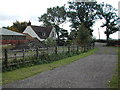
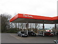
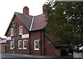
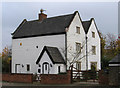
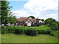
Photos of NG17 1JH


Area Information
NG17 1JH is a small, compact residential postcode area in England, covering just 6.6 hectares. With a population of 2625 and a density of 1992 people per square kilometre, it is a tightly knit community. This area is defined by its proximity to essential services and transport links, making it practical for daily life. The presence of five retail outlets, including Spar, Tesco Sutton, and Co-op Sutton, ensures residents have access to basic shopping needs without long commutes. Nearby rail stations—Kirkby in Ashfield, Sutton Parkway, and Alfreton—connect the area to broader networks, facilitating travel to nearby towns and cities. The low crime risk score of 79 and no flood or environmental constraints suggest a safe, stable environment. While the area is small, its density and connectivity make it a functional choice for those seeking a balance between urban convenience and a quieter residential setting.
- Area Type
- Postcode
- Area Size
- 6.6 hectares
- Population
- 2625
- Population Density
- 1992 people/km²
The property market in NG17 1JH is characterised by high home ownership (87%) and a predominance of houses, indicating a largely owner-occupied area. This suggests a stable market with limited rental activity, as the housing stock is not geared toward short-term tenancies. The compact size of the area—just 6.6 hectares—means the available properties are concentrated, making it a niche market for buyers seeking a specific location. The focus on houses rather than flats or apartments implies a preference for traditional, possibly larger homes. For buyers, this means competition may be fierce due to the limited supply, but the area’s safety and connectivity could justify the investment. Proximity to rail links and retail amenities adds practical value, though the small size may limit options for those seeking a wider range of property types.
House Prices in NG17 1JH
Showing 16 properties
| Address | Type | Beds | Baths | Last Sale Price | Last Sale Date | |
|---|---|---|---|---|---|---|
| 1 Rookery Lane, Fulwood, Sutton In Ashfield, NG17 1JH | Semi-detached | 3 | 1 | £216,000 | Oct 2023 | |
| 9 Rookery Lane, Fulwood, Sutton In Ashfield, NG17 1JH | house | - | - | £150,000 | Aug 2022 | |
| 2 Rookery Lane, Fulwood, Sutton In Ashfield, NG17 1JH | house | - | - | £174,000 | Dec 2021 | |
| 10 Rookery Lane, Fulwood, Sutton In Ashfield, NG17 1JH | Terraced | 2 | 1 | £117,500 | Oct 2020 | |
| 11 Rookery Lane, Fulwood, Sutton In Ashfield, NG17 1JH | house | - | - | £85,000 | Jul 2014 | |
| 4 Rookery Lane, Fulwood, Sutton In Ashfield, NG17 1JH | house | 3 | - | £90,000 | Jun 2013 | |
| 5 Rookery Lane, Fulwood, Sutton In Ashfield, NG17 1JH | house | - | - | £97,000 | Nov 2011 | |
| Hovell Cottage, Rookery Lane, Fulwood, Sutton In Ashfield, NG17 1JH | house | - | - | £180,000 | Nov 2011 | |
| 7 Rookery Lane, Fulwood, Sutton In Ashfield, NG17 1JH | house | - | - | £83,000 | Nov 2010 | |
| 6 Rookery Lane, Fulwood, Sutton In Ashfield, NG17 1JH | Semi-detached | - | - | £110,000 | Dec 2008 |
Energy Efficiency in NG17 1JH
Living in NG17 1JH offers a blend of convenience and accessibility, with essential retail outlets like Spar, Tesco Sutton, and Co-op Sutton within practical reach. These shops provide everyday necessities, reducing the need for long trips to larger centres. The area’s proximity to multiple rail stations—Kirkby in Ashfield, Sutton Parkway, and Alfreton—enhances mobility, allowing residents to commute efficiently to nearby employment hubs or leisure destinations. While the data does not specify parks or recreational facilities, the absence of environmental constraints such as protected woodlands or AONB designations suggests the area is free from restrictions that might limit development or outdoor activities. The compact nature of the postcode means amenities are closely clustered, contributing to a lifestyle that prioritises ease of access over expansive open spaces.
Amenities
Schools
| Rank | School | Type | Entry gender | Ages |
|---|
Explore more schools in this area
Go to Schools tabDemographics
The population of NG17 1JH is predominantly middle-aged, with a median age of 47 and the majority of residents falling within the 30–64 age range. Home ownership is high, at 87%, indicating a community of long-term residents and property owners. The accommodation type is primarily houses, reflecting a residential cluster with limited high-density development. The predominant ethnic group is White, which aligns with broader trends in the region. This demographic profile suggests a stable, established community with a focus on family-oriented living. The high home ownership rate and age distribution imply a low turnover of residents, fostering a sense of continuity. However, the lack of data on deprivation or diversity metrics means the area’s socio-economic nuances remain unexplored beyond the provided statistics.
Household Size
Accommodation Type
Tenure
Ethnic Group
Religion
Household Composition
Age
Household Deprivation
NS-SEC
Explore more demographic insights in this area
Go to Demographics tabPlanning
Planning Constraints
- Flood RiskPremium
- Ramsar Wetland SitesPremium
- Area of Outstanding Natural BeautyPremium
- Protected Nature ReservePremium
- Protected WoodlandPremium